Cycle Tour Cyclovia - Alpe-Adria - Radweg CAAR
Travel report: Von Villach bis nach Grado auf einer alten Eisenbahntrasse
Actions
![]()
Please wait - map data are loading
Added on 27 Nov 2023,
last edited by anjop on 27 Nov 2023
Actions
Cycle route metrics
planned
ridden
Total distance in km
274
275
Cumulative elevation gain in m
1.167
1.166
Avg. slope uphill in %
0,43
0,42
Cumulative elevation loss in m
1.652
1.649
Total cycling hours
-
18,0
Avg. pace in km/h
-
15,3
Information about rights to the gps-track data | |
|---|---|
Rights owner | |
Rights characteristic / license | cc0: Public Domain no Rights reserved |
Link to the description of the license | |
GPX file uploaded | by anjop on 27 Nov 2023
|
Track points in total
7.090
7.110
Track points per km (avg)
26
26
Start/endpoint
Start location
Villach, KTN., AT (498 m NHN)
End location
Cervignano del Friuli, 36, IT (13 m NHN)
Character
This international cycling path, runs mostly along an old train route. It starts in Salzburg, but we cycled from Villach in Austria to Grado at the Adriatic cost. In Carinthia it’s called R1, in Friaul-Veneto-Gulia FVG 1.
From Udine it also follows the EV 8 "Mediterranean Route".
alpe-adria-radweg.com
Information about copyright | |
|---|---|
Rights characteristic / license | by-sa: CREATIVE COMMONS Attribution-ShareAlike |
Link to the description of the license | |
taken over / edited on | 27 Nov 2023
|
taken over / edited by |
|
Landscape
From Tarvisio to Venzone, the route runs through a narrow valley between towering mountains. From Venzone and especially from Udine, the valley widens and is very much characterised by agriculture.
Information about copyright | |
|---|---|
Rights characteristic / license | by-sa: CREATIVE COMMONS Attribution-ShareAlike |
Link to the description of the license | |
taken over / edited on | 27 Nov 2023
|
taken over / edited by |
|
Travel to and from ...
This international cycle route is easily accessible by train. If you are not already cycling it from Salzburg, various places can be easily reached from Salzburg or Vienna with EC or RailJet connections. However, it is advisable to reserve spaces for your bikes in good time.
For the return journey, cycle to Cervignano and from there take a regional train to Udine. From Udine, the ÖBB train runs again via Villach to Salzburg or Vienna.
All tickets and reservations can be booked via ÖBB. Only the Cervignano - Udine cycle ticket is only available from the ticket machine at Cervignano station.
Sources of information
Stages
Information about copyright | |
|---|---|
Rights owner | |
Rights characteristic / license | by-sa: CREATIVE COMMONS Attribution-ShareAlike |
Link to the description of the license | |
Image has been uploaded | by anjop on 27 Nov 2023
|
2 km
Villach
Information about copyright | |
|---|---|
Rights owner | |
Rights characteristic / license | by-sa: CREATIVE COMMONS Attribution-ShareAlike |
Link to the description of the license | |
Image has been uploaded | by anjop on 27 Nov 2023
|
53 km
Törl-Maglan, Tarvis,
Information about copyright | |
|---|---|
Rights owner | |
Rights characteristic / license | by-sa: CREATIVE COMMONS Attribution-ShareAlike |
Link to the description of the license | |
Image has been uploaded | by anjop on 27 Nov 2023
|
50 km
Pontebba, Chuisaforte, Moggio
Information about copyright | |
|---|---|
Rights owner | |
Rights characteristic / license | by-sa: CREATIVE COMMONS Attribution-ShareAlike |
Link to the description of the license | |
Image has been uploaded | by anjop on 27 Nov 2023
|
62 km
Osoppo
Information about copyright | |
|---|---|
Rights owner | |
Rights characteristic / license | by-sa: CREATIVE COMMONS Attribution-ShareAlike |
Link to the description of the license | |
Image has been uploaded | by anjop on 27 Nov 2023
|
64 km
Palmanova, Cervignano, Aquliea
Information about copyright | |
|---|---|
Rights owner | |
Rights characteristic / license | by-sa: CREATIVE COMMONS Attribution-ShareAlike |
Link to the description of the license | |
Image has been uploaded | by anjop on 27 Nov 2023
|
25 km
Grado Pineta
Information about copyright | |
|---|---|
Rights owner | |
Rights characteristic / license | by-sa: CREATIVE COMMONS Attribution-ShareAlike |
Link to the description of the license | |
Image has been uploaded | by anjop on 27 Nov 2023
|
19 km
Aquliea
Beds4Cyclists, worth visiting and infrastructure
Name and address
Latitude / Longitude
Phone
Fax
Mobile
Type of accommodation
Rating for cyclists
Route km
Dist. to route
Elevation
0 km
0,1 km
508 m
2 km
0,0 km
514 m
4 km
0,0 km
504 m
4 km
0,0 km
499 m
Information about copyright | |
|---|---|
Rights owner | |
Rights characteristic / license | by-sa: CREATIVE COMMONS Attribution-ShareAlike |
Link to the description of the license | |
Image taken over from | https://commons.wikimedia.org/wiki/File:Villach_Kirchenplatz_Pfarrkirche_hl_Jakob_07082015_6568.jpg |
Image has been uploaded | by biroto-Redaktion on 31 Aug 2016
|
Information about copyright | |
|---|---|
Rights owner | |
Rights characteristic / license | by-sa: CREATIVE COMMONS Attribution-ShareAlike |
Link to the description of the license | |
Image taken over from | https://commons.wikimedia.org/wiki/File:Villach_Hauptplatz_30012011_666.jpg |
Image has been uploaded | by biroto-Redaktion on 31 Aug 2016
|
Information about copyright | |
|---|---|
Rights owner | |
Rights characteristic / license | by-sa: CREATIVE COMMONS Attribution-ShareAlike |
Link to the description of the license | |
Image taken over from | https://commons.wikimedia.org/wiki/File:Villach_Lederergasse_Hegerhaus_23032015_1088.jpg |
Image has been uploaded | by biroto-Redaktion on 31 Aug 2016
|
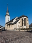
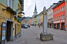
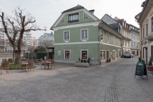
Villach is a town located in Carinthia in Austria. It has about 60,000 inhabitants.
Understand
Villach is the second-largest city of Carinthia. It is a railway gateway to most parts of Austria as well as the Italian border. In Austria Villach is well-known for its carnival which is broadcast on public television throughout Austria. Villach is quite an old city with roots back in Roman times (when the city was called Santicum).The city was heavily bombed in World War II destroying many parts of the city.
See
- ⊙Museum der Stadt Villach - if you are interested in the history of the town go there. The museum has a nice expo on minerals, mining and all kinds of Villacher History. Nice to visit for some background info on the town of Villach. Time to visit approx. 1 hour.
Widmanngasse 38, +43 4242 2053500, Tu to Su 10:00 - 16:30 - ⊙The bell tower of St Jakob - The church of St Jakob (the parish church of Villach) has an impressive bell tower, 94 metres high. It is the tallest in Carinthia and its present appearance and height dates back to 1847. Visitors can climb the 239 steps to the top and enjoy the wonderful view.
Information about copyright | |
|---|---|
Rights characteristic / license | by-sa: CREATIVE COMMONS Attribution-ShareAlike |
Link to the description of the license | |
Input taken over from: |
Wikivoyage contributors, 'Villach', Wikivoyage, The FREE worldwide travel guide that anyone can edit, 10 September 2015, 15:02 UTC, https://en.wikivoyage.org/w/index.php?title=Villach&oldid=2855200 |
taken over / edited on | 30 Aug 2016 - 05 May 2022
|
taken over / edited by |
|
4 km
0,0 km
486 m
Hours of opening
Jänner bis April:
Montag bis Freitag von 9 bis 17 Uhr
Samstag geschlossen
1. Mai bis 30. Juni:
Montag bis Freitag von 9 bis 18 Uhr
Samstag von 10 bis 14 Uhr
1. Juli bis 31. August:
Montag bis Freitag von 9 bis 19 Uhr
Samstag von 10 bis 16 Uhr
1. September bis 31. Oktober:
Montag bis Freitag von 9 bis 18 Uhr
Samstag von 10 bis 14 Uhr
November:
Montag bis Freitag von 9 bis 17 Uhr
Samstag geschlossen
Dezember:
Montag bis Freitag von 9 bis 17 Uhr
Samstag von 10 bis 16 Uhr
![]()


