Cycle Tour Iron Curtain Tour, part 3 Gdynia-Aš
Dag/day 27: Eisenach-Tann/Dippach
![]()
Please wait - map data are loading
Added on 14 Jun 2023
last edited by Ottocolor on 01 Aug 2023
Cycle route metrics
ridden
Total distance in km
90
Cumulative elevation gain in m
782
Avg. slope uphill in %
0,87
Cumulative elevation loss in m
606
Min. height
198
Max. height
436
Information about rights to the gps-track data | |
|---|---|
Rights owner | |
Rights characteristic / license | cc0: Public Domain no Rights reserved |
Link to the description of the license | |
GPX file uploaded | by Ottocolor on 15 Jun 2023
|
Track points in total
1.486
Track points per km (avg)
17
Start/endpoint
Start location
Eisenach, TH, DE (257 m NHN)
End location
Tann (Rhön), HE, DE (433 m NHN)
ridden on
04 Jun 2023
Weather
Warm and fairly hot all day into the evening. Sunny with a light to moderate northeasterly breeze.
Slope Gradient Distribution
Remarks
I extended today's stage with about 20 km instead of going to Rasdorf, as time allowed it and I intended to shorten next day's stage.
Travel report
Information about copyright | |
|---|---|
Rights owner | |
Rights characteristic / license | by-sa: CREATIVE COMMONS Attribution-ShareAlike |
Link to the description of the license | |
Image has been uploaded | by Ottocolor on 01 Aug 2023
|
Information about copyright | |
|---|---|
Rights owner | |
Rights characteristic / license | by-sa: CREATIVE COMMONS Attribution-ShareAlike |
Link to the description of the license | |
Image has been uploaded | by Ottocolor on 01 Aug 2023
|
Information about copyright | |
|---|---|
Rights owner | |
Rights characteristic / license | by-sa: CREATIVE COMMONS Attribution-ShareAlike |
Link to the description of the license | |
Image has been uploaded | by Ottocolor on 01 Aug 2023
|
Information about copyright | |
|---|---|
Rights owner | |
Rights characteristic / license | by-sa: CREATIVE COMMONS Attribution-ShareAlike |
Link to the description of the license | |
Image has been uploaded | by Ottocolor on 01 Aug 2023
|
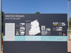
Today I continued the ride south along the Werra to Philippsthal and then along its tributary the Ulster. First point of interest was at the old border checkpoint in Herleshausen on the West German side. Here, large posters told about the many freed East Germans in particular, who were driven here from a prison in Chemnitz/Karl-Marx-Stadt. In this way, the GDR got rid of problem citizens who were political prisoners and instead West Germany paid the country good currency to be allowed to receive them. It was pure human trafficking. Known persons were particularly expensive.
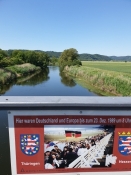
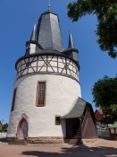
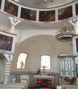
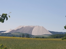
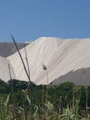
It was again a lovely cycling day on good paths along the Werra still with the wind in the north and east. In Gerstungen I had lunch in a lonely park and lay in the shade under a tree afterwards. Soon after, I looked at the round church in Untersuhl, which is completely unique and can probably only be compared to the ones in Bornholm. But it was still completely different and not nearly as old. Soon after, "Monte Kali" appeared on the horizon, a huge mountain of unusable residues from potash production, used primarily for fertilizer. They even make guided tours onto this approx. 150 m high flat artificial mountain, which is also called Kalimandjaro. The large factory is located in Heringen. But since today was Sunday, everything was quiet. On the other hand, there was life elsewhere along the river with small local festivals.
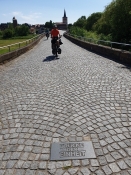
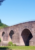
I shortly attended one in Philippsthal by the castle, where the theme was the Middle Ages. It was enjoyable to see the many costumed organizers. A band played German pop music rather loudly. A medieval orchestra with lute and horn would have been more appropriate. Of course I accepted the offer of coffee and no less than three pieces of cake. The Germans really know how to take in cake, especially layer cake with whipped cream. Soon after I cycled across the "Bridge of German Reunification" to Vacha in Thuringia, i.e. ex-GDR. It's a beautiful medieval bridge over the Werra, which once connected Leipzig and Frankfurt. But in the dark years 1949-90, it was completely blocked off, as it was completely on the GDR side. A house directly opposite the bridge was divided into a western and an eastern part. Only in the 70s, the owner in the west managed to gain access to his entire house. Today the bridge is a beautiful sight with its old arches in pink stone.
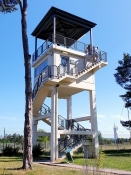
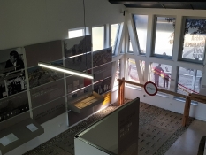
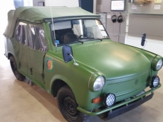
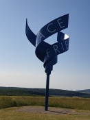
From Vacha I cycled back to Philippsthal on the other bank of the Werra and then bid farewell to the river in favor of the Ulster. Here there were just as nice paths, so I made fast progress to the south. It was indeed necessary as I wanted to make it to Point Alpha, which I knew closed at 18. And there was a proper climb up there, as the observation point stood uphill with a good view over to the then enemy. And it was absolutely necessary to keep a close eye, because here the Americans (Hessen was part of their occupation zone) assumed that the attack from the Soviet Union would come, if it ever came, through the so-called Fulda Gap. Several geographical conditions spoke for it, i.a. that it was the westernmost point of the Warsaw Pact, and that there were no natural obstacles to such an important city as Frankfurt. So here the nuclear war would have started, one could conclude. I climbed the original US observation tower from 1985 and also a quick trip through the "House on the border", a good museum, located on the former border itself, so that the patrol road went right through an exhibition hall. My only problem was that I was terribly thirsty afterwards, but everything was closed up here. It had to wait. Fortunately, I'm good at repressing those kinds of urgent needs.
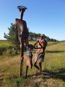
In fact, I felt strong and fresh, so I chose to cycle on to the next campsite instead of the planned one in Rasdorf. It would shorten the next day's stage, which I knew would be tough through the Rhoen mountains. First came a series of rusty iron works of art on the border itself. I liked them. They addressed the degrading and humiliating aspects of the border. Then it went downhill at a rushing speed to Geisa, where I filled up with water.
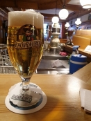
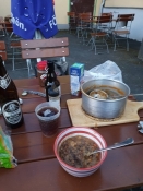
In the charming town of Tann, I had one of the best beers of the whole trip, a local Rhoenraeuber ("Rhoen bandit"), in a stylish pub, also because I really needed it. Now it was only a few kilometers to Dippach, where there was a campsite. But of course it involved an ugly climb again, which I really didn't fancy. But then the reception by the campsite landlady, on the other hand, was simply wonderful. And so was the weather. Sunny and warm, but not hot anymore. And after a bath, I was served my own lentil soup from a satchet in my own pot. With accompanying delicious local beer. My tent was pitched near a babbling brook, so it was really hard to be unhappy about anything.
Information about copyright | |
|---|---|
Rights characteristic / license | by-sa: CREATIVE COMMONS Attribution-ShareAlike |
Link to the description of the license | |
taken over / edited on | 01 Aug 2023
|
taken over / edited by |
|
Information about copyright | |
|---|---|
Rights owner | |
Rights characteristic / license | by-sa: CREATIVE COMMONS Attribution-ShareAlike |
Link to the description of the license | |
Image has been uploaded | by Ottocolor on 01 Aug 2023
|
Information about copyright | |
|---|---|
Rights owner | |
Rights characteristic / license | by-sa: CREATIVE COMMONS Attribution-ShareAlike |
Link to the description of the license | |
Image has been uploaded | by Ottocolor on 01 Aug 2023
|
Information about copyright | |
|---|---|
Rights owner | |
Rights characteristic / license | by-sa: CREATIVE COMMONS Attribution-ShareAlike |
Link to the description of the license | |
Image has been uploaded | by Ottocolor on 01 Aug 2023
|
Information about copyright | |
|---|---|
Rights owner | |
Rights characteristic / license | by-sa: CREATIVE COMMONS Attribution-ShareAlike |
Link to the description of the license | |
Image has been uploaded | by Ottocolor on 01 Aug 2023
|
Information about copyright | |
|---|---|
Rights owner | |
Rights characteristic / license | by-sa: CREATIVE COMMONS Attribution-ShareAlike |
Link to the description of the license | |
Image has been uploaded | by Ottocolor on 01 Aug 2023
|
Information about copyright | |
|---|---|
Rights owner | |
Rights characteristic / license | by-sa: CREATIVE COMMONS Attribution-ShareAlike |
Link to the description of the license | |
Image has been uploaded | by Ottocolor on 01 Aug 2023
|
Information about copyright | |
|---|---|
Rights owner | |
Rights characteristic / license | by-sa: CREATIVE COMMONS Attribution-ShareAlike |
Link to the description of the license | |
Image has been uploaded | by Ottocolor on 01 Aug 2023
|
Information about copyright | |
|---|---|
Rights owner | |
Rights characteristic / license | by-sa: CREATIVE COMMONS Attribution-ShareAlike |
Link to the description of the license | |
Image has been uploaded | by Ottocolor on 01 Aug 2023
|
Information about copyright | |
|---|---|
Rights owner | |
Rights characteristic / license | by-sa: CREATIVE COMMONS Attribution-ShareAlike |
Link to the description of the license | |
Image has been uploaded | by Ottocolor on 01 Aug 2023
|
Information about copyright | |
|---|---|
Rights owner | |
Rights characteristic / license | by-sa: CREATIVE COMMONS Attribution-ShareAlike |
Link to the description of the license | |
Image has been uploaded | by Ottocolor on 01 Aug 2023
|
Information about copyright | |
|---|---|
Rights owner | |
Rights characteristic / license | by-sa: CREATIVE COMMONS Attribution-ShareAlike |
Link to the description of the license | |
Image has been uploaded | by Ottocolor on 01 Aug 2023
|
Information about copyright | |
|---|---|
Rights owner | |
Rights characteristic / license | by-sa: CREATIVE COMMONS Attribution-ShareAlike |
Link to the description of the license | |
Image has been uploaded | by Ottocolor on 01 Aug 2023
|
Information about copyright | |
|---|---|
Rights owner | |
Rights characteristic / license | by-sa: CREATIVE COMMONS Attribution-ShareAlike |
Link to the description of the license | |
Image has been uploaded | by Ottocolor on 01 Aug 2023
|

