
Cycle Tour Tauern-Adria-Dolomiten-Runde
Tag 20: Wanderung zur Buchensteinwand
![]()
Please wait - map data are loading
Added on 12 Aug 2016
last edited by Tandemteam-Traudel_und_Dieter on 19 Dec 2016
Cycle route metrics
ridden
Total distance in km
11
Cumulative elevation gain in m
633
Avg. slope uphill in %
5,75
Cumulative elevation loss in m
620
Min. height
776
Max. height
1.380
Information about rights to the gps-track data | |
|---|---|
Rights owner | |
Rights characteristic / license | by-sa: CREATIVE COMMONS Attribution-ShareAlike |
Link to the description of the license | |
GPX file uploaded | by Tandemteam-Traudel_und_Dieter on 19 Dec 2016
|
Track points in total
493
Track points per km (avg)
45
Start/endpoint
Start location
St. Ulrich am Pillersee, Tirol, AT (792 m NHN)
End location
St. Ulrich am Pillersee, Tirol, AT (804 m NHN)
ridden on
13 Jul 2016
Weather
Nieselregen
Properties
Almweg
Travel report
Information about copyright | |
|---|---|
Rights owner | |
Rights characteristic / license | © all rights reserved. |
Image has been uploaded | by Tandemteam-Traudel_und_Dieter on 19 Dec 2016
|
Information about copyright | |
|---|---|
Rights owner | |
Rights characteristic / license | © all rights reserved. |
Image has been uploaded | by Tandemteam-Traudel_und_Dieter on 19 Dec 2016
|
Information about copyright | |
|---|---|
Rights owner | |
Rights characteristic / license | © all rights reserved. |
Image has been uploaded | by Tandemteam-Traudel_und_Dieter on 19 Dec 2016
|
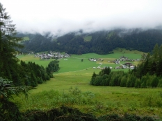
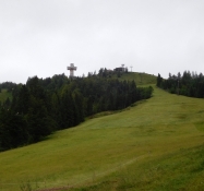
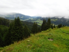
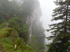
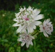
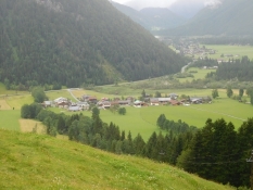
Am Ende noch eine Wanderung zur Buchensteinwand, dem Hausberg von Flecken. Bei leichtem Nieselregen wanderten wir zum Gipfel der Buchensteinwand. Vorbei am Jakobuskreuz, und über den Blumenlehrpfad bei mäßiger Sicht wieder zurück nach Flecken. Die Buchensteinwand lässt sich auch gut mit dem Mountainbike radeln.
Information about copyright | |
|---|---|
Rights characteristic / license | by-sa: CREATIVE COMMONS Attribution-ShareAlike |
Link to the description of the license | |
taken over / edited on | 19 Dec 2016
|
taken over / edited by |
|
Information about copyright | |
|---|---|
Rights owner | |
Rights characteristic / license | © all rights reserved. |
Image has been uploaded | by Tandemteam-Traudel_und_Dieter on 19 Dec 2016
|
Information about copyright | |
|---|---|
Rights owner | |
Rights characteristic / license | © all rights reserved. |
Image has been uploaded | by Tandemteam-Traudel_und_Dieter on 19 Dec 2016
|
Information about copyright | |
|---|---|
Rights owner | |
Rights characteristic / license | © all rights reserved. |
Image has been uploaded | by Tandemteam-Traudel_und_Dieter on 19 Dec 2016
|