
Cycle Tour The Rhone from Geneva to the Mediterranean
Tag 9: Bourg-Saint-Andéol - Le Pont dʹArc
![]()
Please wait - map data are loading
Added on 16 Dec 2013
last edited by Tandemteam-Traudel_und_Dieter on 29 Dec 2014
Cycle route metrics
ridden
Total distance in km
63
Cumulative elevation gain in m
1.123
Avg. slope uphill in %
1,78
Cumulative elevation loss in m
1.078
Total cycling hours
5,5
Avg. pace in km/h
11,5
Min. height
40
Max. height
345
Information about rights to the gps-track data | |
|---|---|
Rights owner | |
Rights characteristic / license | by-sa: CREATIVE COMMONS Attribution-ShareAlike |
Link to the description of the license | |
GPX file uploaded | by Tandemteam-Traudel_und_Dieter on 18 Dec 2013
|
Track points in total
561
Track points per km (avg)
9
Start/endpoint
Start location
Bourg-Saint-Andéol, Auvergne-Rhône-Alpes, FR (65 m NHN)
End location
Vallon-Pont-d'Arc, Auvergne-Rhône-Alpes, FR (110 m NHN)
ridden on
16 Jun 2013
Weather
Sonnig
Properties
Straße
Travel report
Information about copyright | |
|---|---|
Rights owner | |
Rights characteristic / license | © all rights reserved. |
Image has been uploaded | by Tandemteam-Traudel_und_Dieter on 29 Dec 2014
|
Information about copyright | |
|---|---|
Rights owner | |
Rights characteristic / license | © all rights reserved. |
Image has been uploaded | by Tandemteam-Traudel_und_Dieter on 29 Dec 2014
|
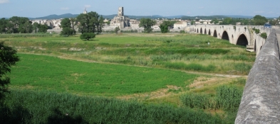
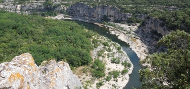
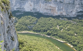
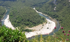
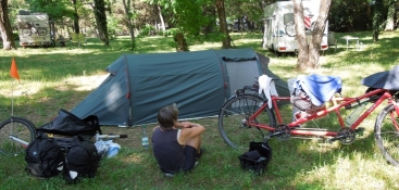
Von Bourg-Saint-Andéol auf Nebenstraßen nach Pont-Saint-Esprit, und weiter auf der D 6086 und D901 bis Saint-Martin-d'Ardèche. Ab Saint-Martin-d'Ardèche auf der D 290 geht es bergig weiter bis zum Campingplatz du Pont d'Arc. Unterwegs hat man schöne Aussichten in die Felsenschlucht der Ardèche. Durch die Hitze und die Steigungen in der Ardèche war unser Wasservorrat früher aufgebraucht, als wir dachten. Wir hatten noch zwei Äpfel, die gaben uns wieder Energie für die letzten Anstiege.
Information about copyright | |
|---|---|
Rights characteristic / license | by-sa: CREATIVE COMMONS Attribution-ShareAlike |
Link to the description of the license | |
taken over / edited on | 20 Dec 2013 - 02 Jan 2014
|
taken over / edited by |
|
Information about copyright | |
|---|---|
Rights owner | |
Rights characteristic / license | © all rights reserved. |
Image has been uploaded | by Tandemteam-Traudel_und_Dieter on 29 Dec 2014
|
Information about copyright | |
|---|---|
Rights owner | |
Rights characteristic / license | © all rights reserved. |
Image has been uploaded | by Tandemteam-Traudel_und_Dieter on 29 Dec 2014
|
Information about copyright | |
|---|---|
Rights owner | |
Rights characteristic / license | © all rights reserved. |
Image has been uploaded | by Tandemteam-Traudel_und_Dieter on 29 Dec 2014
|
Information about copyright | |
|---|---|
Rights owner | |
Rights characteristic / license | © all rights reserved. |
Image has been uploaded | by Tandemteam-Traudel_und_Dieter on 29 Dec 2014
|