Cycle Tour Von Domodossola nach Venedig. BI12 & AIDA
Planned tour
Actions
![]()
Please wait - map data are loading
Added on 20 Sep 2023,
last edited by alexs77 on 20 Sep 2023
Actions
Cycle route metrics
planned
ridden
Total distance in km
479
0
Cumulative elevation gain in m
4.636
0
Avg. slope uphill in %
0,97
-
Cumulative elevation loss in m
4.923
0
Information about rights to the gps-track data | |
|---|---|
Rights owner | |
Rights characteristic / license | cc0: Public Domain no Rights reserved |
Link to the description of the license | |
GPX file uploaded | by alexs77 on 20 Sep 2023
|
Track points in total
9.393
0
Track points per km (avg)
20
0
Start/endpoint
Start location
Domodossola, 21, IT (291 m NHN)
End location
Venezia, 34, IT (5 m NHN)
Beds4Cyclists, worth visiting and infrastructure
Name and address
Latitude / Longitude
Phone
Fax
Mobile
Type of accommodation
Rating for cyclists
Route km
Dist. to route
Elevation
0 km
1,2 km
323 m
0 km
0,1 km
293 m
0 km
0,1 km
287 m
Information about copyright | |
|---|---|
Rights owner | |
Rights characteristic / license | by-sa: CREATIVE COMMONS Attribution-ShareAlike |
Link to the description of the license | |
Image taken over from | commons.wikimedia.org/wiki/File:Domodossola_centro_storico.jpg |
Image has been uploaded | by biroto-Redaktion on 05 Mar 2014
|
Information about copyright | |
|---|---|
Rights owner | |
Rights characteristic / license | by-sa: CREATIVE COMMONS Attribution-ShareAlike |
Link to the description of the license | |
Image taken over from | commons.wikimedia.org/wiki/File:Domodossola_198_(8188045041).jpg |
Image has been uploaded | by biroto-Redaktion on 05 Mar 2014
|
Information about copyright | |
|---|---|
Rights owner | |
Rights characteristic / license | by-sa: CREATIVE COMMONS Attribution-ShareAlike |
Link to the description of the license | |
Image taken over from | |
Image has been uploaded | by biroto-Redaktion on 05 Mar 2014
|
Information about copyright | |
|---|---|
Rights owner | |
Rights characteristic / license | by-sa: CREATIVE COMMONS Attribution-ShareAlike |
Link to the description of the license | |
Image taken over from | |
Image has been uploaded | by biroto-Redaktion on 05 Mar 2014
|
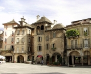
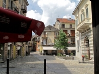
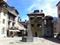
Domodossola (Piedmontese: Dòm) is a city and comune in the Province of Verbano-Cusio-Ossola, in the region of Piedmont, northern Italy. It was also known as Oscela, Oscella, Oscella dei Leponzi, Ossolo, Ossola Lepontiorum, and Domo d'Ossola (due to its position in the Ossola valley ).
Main sights
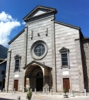
- Collegiate church of St. Gervasius and Protasius.
- Palazzo Silva (17th century).
Domodossola is most famous for the Sacro Monte Calvario , a site of pilgrimage and worship close to it.
Information about copyright | |
|---|---|
Rights characteristic / license | by-sa: CREATIVE COMMONS Attribution-ShareAlike |
Link to the description of the license | |
Input taken over from: |
Wikipedia contributors, 'Domodossola', Wikipedia, The Free Encyclopedia, 10 January 2014, 15:44 UTC, <http://en.wikipedia.org/w/index.php?title=Domodossola&oldid=590084920> [accessed 5 March 2014] |
taken over / edited on | 05 Mar 2014
|
taken over / edited by |
|
1 km
0,4 km
293 m
Hours of opening
Monday to Friday: 8:30 - 12:30 and 14:00 - 18:00
Saturday 8:30 - 12:30
1 km
0,0 km
278 m
![]()


