Cycle Tour Bilbao - Cape Finisterre
Planned tour: Camino de Santiago de la Costa/Camino de Santiago a Finisterre
Actions
![]()
Please wait - map data are loading
Added on 07 Feb 2014,
last edited by biroto-Redaktion on 11 May 2016
Actions
Cycle route metrics
planned
ridden
Total distance in km
778
0
Cumulative elevation gain in m
16.163
0
Avg. slope uphill in %
2,08
-
Cumulative elevation loss in m
16.077
0
Information about rights to the gps-track data | |
|---|---|
Rights owner | Openstreetmap and Contributors + biroto-Redaktion (biroto.eu) |
Rights characteristic / license | Contains information from OpenStreetMap, which is made available here under the Open Database License(ODbL) |
Link to the description of the license | |
GPX file taken from | |
GPX file uploaded | by biroto-Redaktion on 14 Feb 2014
|
Track points in total
15.156
0
Track points per km (avg)
19
0
Start/endpoint
Start location
Bilbao, País Vasco, ES (28 m NHN)
End location
Finisterre, Galicia, ES (114 m NHN)
Beds4Cyclists, worth visiting and infrastructure
Name and address
Latitude / Longitude
Phone
Fax
Mobile
Type of accommodation
Rating for cyclists
Route km
Dist. to route
Elevation
0 km
0,0 km
25 m
0 km
0,5 km
19 m
Information about copyright | |
|---|---|
Rights owner | |
Rights characteristic / license | by-sa: CREATIVE COMMONS Attribution-ShareAlike |
Link to the description of the license | |
Image taken over from | |
Image has been uploaded | by biroto-Redaktion on 14 Feb 2014
|
Information about copyright | |
|---|---|
Rights owner | |
Rights characteristic / license | by-sa: CREATIVE COMMONS Attribution-ShareAlike |
Link to the description of the license | |
Image taken over from | |
Image has been uploaded | by biroto-Redaktion on 14 Feb 2014
|
Information about copyright | |
|---|---|
Rights owner | |
Rights characteristic / license | by-sa: CREATIVE COMMONS Attribution-ShareAlike |
Link to the description of the license | |
Image taken over from | |
Image has been uploaded | by biroto-Redaktion on 14 Feb 2014
|
Information about copyright | |
|---|---|
Rights owner | |
Rights characteristic / license | by-sa: CREATIVE COMMONS Attribution-ShareAlike |
Link to the description of the license | |
Image taken over from | |
Image has been uploaded | by biroto-Redaktion on 14 Feb 2014
|
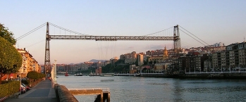
Bilbao (/bɪlˈbaʊ/, /bɪlˈbɑːoʊ/;Spanish: [bilˈβao]; Basque: Bilbo [bilβo]) is a municipality and city in Spain, the capital of the province of Biscay in the autonomous community of the Basque Country. With a population of 353,187 as of 2010, it is the largest city of its autonomous community and the tenth largest in Spain. With roughly 1 million inhabitants, Bilbao lies within one of the most populous metropolitan areas in northern Spain.
Bilbao's buildings display a variety of architectural styles, ranging from gothic to contemporary architecture. The ⊙Old Town features many of the oldest buildings in the city, as the ⊙St. James' Cathedral
or the ⊙Church of San Antón
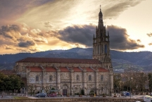
, included in the city's coat of arms. Most of the Old Town is a pedestrian zone during the day. Nearby is one of the most important religious temples of Biscay, the ⊙Basilica of Begoña
, dedicated to the patron saint of the province, Our Lady of Begoña.
Main Sights
⊙ Casco Viejo
Las Siete Calles or Casco Viejo in Spanish or Zazpikaleak or Alde Zaharra in Basque are different names for the medieval neighbourhood of Bilbao, part of the Ibaiondo district. The names mean Seven Streets or Old Town respectively and it used to be the walled part of the town until the end of the 19th century.
The area is probably the most colorful part of Bilbao, including many shops and taverns, several historical churches (San Antón, Santos Juanes, ⊙the Cathedral , San Nicolás), the largest food retail market of Europe (Mercado de la Ribera), the public Arriaga Theatre
, the seat of the Academy of the Basque Language (Euskaltzaindia), a ball court
, and a public library. It is connected to the rest of the city and conurbation by the subway, tramway and buses. Three public elevators also connect Casco Viejo to the neighbourhoods of Begoña
and Solokoetxe, which otherwise demand a rather intense uphill walk.
⊙ Guggenheim Museum Bilbao
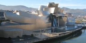
The Guggenheim Museum Bilbao is a museum of modern and contemporary art, designed by Canadian-American architect Frank Gehry, and located in Bilbao, Basque Country. The museum was inaugurated on 18 October 1997 by King Juan Carlos I of Spain.
It is built alongside the Nervion River , which runs through the city of Bilbao to the Cantabrian Sea
. The Guggenheim is one of several museums belonging to the Solomon R. Guggenheim Foundation. The museum features permanent and visiting exhibits of works by Spanish and international artists.
Information about copyright | |
|---|---|
Rights characteristic / license | by-sa: CREATIVE COMMONS Attribution-ShareAlike |
Link to the description of the license | |
Input taken over from: |
|
taken over / edited on | 14 Feb 2014 - 14 Jan 2017
|
taken over / edited by |
|
18 km
0,1 km
6 m
49 km
0,1 km
15 m
Information about copyright | |
|---|---|
Rights owner | |
Rights characteristic / license | by: CREATIVE COMMONS Attribution |
Link to the description of the license | |
Image taken over from | commons.wikimedia.org/wiki/File:Castro_Urdiales._Puebla_Vieja.jpg |
Image has been uploaded | by biroto-Redaktion on 14 Feb 2014
|
Information about copyright | |
|---|---|
Rights owner | |
Rights characteristic / license | by-sa: CREATIVE COMMONS Attribution-ShareAlike |
Link to the description of the license | |
Image taken over from | |
Image has been uploaded | by biroto-Redaktion on 14 Feb 2014
|
Information about copyright | |
|---|---|
Rights owner | |
Rights characteristic / license | by: CREATIVE COMMONS Attribution |
Link to the description of the license | |
Image taken over from | |
Image has been uploaded | by biroto-Redaktion on 14 Feb 2014
|
Information about copyright | |
|---|---|
Rights owner | |
Rights characteristic / license | cc0: Public Domain no Rights reserved |
Link to the description of the license | |
Image taken over from | commons.wikimedia.org/wiki/File:Castro-Urdiales_-_Ayuntamiento_4.JPG |
Image has been uploaded | by biroto-Redaktion on 14 Feb 2014
|
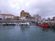
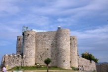
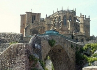
Castro Urdiales is a seaport of northern Spain, in the autonomous community of Cantabria, situated on the bay of Biscay. Castro Urdiales is a modern town, although its castle and the Gothic-style parish church of Santa María de la Asunción, date from the Middle Ages. Its chief industries are tourism, fishing, and the preservation of fish, especially sardines and anchovies, in oil. The "Lolin" and "La Castreña" anchovy canning factories serve as a reminder of the town's closeness to this industry and its proximity to the sea.
Tourism has greatly increased in Castro Urdiales in the last thirty years; many people from Bilbao and other parts of the Basque Country and Cantabria as well as Northern Spain in general keep summer homes in the town. Although the number of people registered in the town is around 32,000, the summer population can double or even triple this figure.The town is popular because of its beaches and scenic harbor. The commercial fishing industry is declining and may soon be eradicated completely.
Main sights
The monument complex of Castro Urdiales, also known as Puebla Vieja, has medieval origins and is located near the sea. It was declared a Conjunto histórico in 1978.
The Church of Santa María de la Asunción is in Gothic style. Built under the protection of King Alfonso VIII of Castile in the 13th century (though it was finished in the 15th century), it is a basilica church with three naves. In the interior are the images of the White Virgin and the Reclining Christ, and three Gothic carvings of the Magi . It was declared a National Monument in 1931.
The Castle of Santa Ana is located near the port and the church of Santa María de la Asunción. In modern times it housed a lighthouse.
Other sights include:
- Palace, castle-observatory and Ocharan gardens, protected since 1985. The castle-observatory, dating back to 1914 and designed by local architect Eladio Laredo, is in neo-Gothic style. The Ocharan Palace, or Toki-Eder, was built in 1901, also by the local architect Eladio Laredo. It is an eclectic-style building, with a portico of columns and other elements of Greek taste, and with a multicolored tile frieze designed by Daniel Zuloaga.
- Ruins of the medieval tower of the Templars, in Allendelagua, on the mountain side. It belonged to the Knights Templars and is currently in poor condition.
- Cave of El Cuco, west of the town. It houses rock carvings and paintings from the Upper Paleolithic period, which depict animals such as deers, goats and horses.
- Cave of La Lastrilla
- Cave Grande or de los Corrales
- Cave Aurelia
- Castro of la Peña de Sámano
- Remains of Flavióbriga and the medieval village, protected since 1996. The Flavióbriga archaeological site is under the Old town, two meters deep. Remains of a Roman colony can be visited in the Regional Museum of Prehistory and Archaeology of Cantabria.
- Water driving of El Chorrillo, a work of hydraulic engineering from the Roman age.
- Tower-House of Los Otañes, in Otañes.
- Ruins of the Hospital de la Vera Cruz, in Islares.
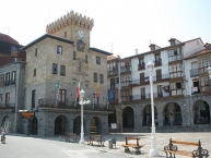
- City Hall (16th century)
- Tower-House of Cerdigo, built in Cerdigo between the 17th and 18th centuries.
- Archaeological site of Patera de Otañes, in the village of Otañe.
- Roman mile-stone, opposite the Church of Santa María. Dating to 61 AD, it marked the distance to Pisoraca
. It has an inscription that reads "Nero Claudius, son of the divine Claudius, Caesar, Augustus, Germanicus, Pontifex maximus, with the tribunician power for eighth time, the empire for ninth and the consulate for fourth. From Pisoraca one hundred and eighty miles".
- Iglesia de San Pedro (11th century), in Romanesque style.
Information about copyright | |
|---|---|
Rights characteristic / license | by-sa: CREATIVE COMMONS Attribution-ShareAlike |
Link to the description of the license | |
Input taken over from: |
Wikipedia contributors, 'Castro Urdiales', Wikipedia, The Free Encyclopedia, 15 September 2013, 11:46 UTC, <http://en.wikipedia.org/w/index.php?title=Castro_Urdiales&oldid=573006783> [accessed 14 February 2014] |
taken over / edited on | 14 Feb 2014 - 15 Feb 2014
|
taken over / edited by |
|
74 km
0,1 km
11 m
![]()

