
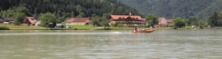
Mühltal Cycle Route
No. of cycle route R26
Actions
![]()
Please wait - map data are loading
Added on 16 Oct 2013,
last edited by biroto-Redaktion on 25 Oct 2023
Actions
Cycle route metrics
Total distance in km
40
Information about rights to the gps-track data | |
|---|---|
Rights owner | OpenStreetMap and Contributors + biroto-Redaktion (biroto.eu) |
Rights characteristic / license | Contains information from OpenStreetMap, which is made available here under the Open Database License(ODbL) |
Link to the description of the license | |
GPX file taken from | |
GPX file uploaded | by biroto-Redaktion on 25 Oct 2023
|
Track points in total
986
Track points per km (avg)
25
Start/endpoint
Start location
Schwarzenberg am Böhmerwald, OÖ, AT (592 m NHN)
End location
Kirchberg ob der Donau, OÖ, AT (291 m NHN)
Travel reports about cycle tours
05 Jul 2015
76 km
A stage of the tour »Danube - Vltava - Elbe« of user ThimbleU
Beds4Cyclists, worth visiting and infrastructure
Name and address
Latitude / Longitude
Phone
Fax
Mobile
Type of accommodation
Rating for cyclists
Route km
Dist. to route
Elevation
2 km
0,8 km
622 m
3 km
4,6 km
740 m
7 km
1,3 km
651 m
7 km
0,0 km
626 m
8 km
0,0 km
581 m
![]()