Cycle Tour From the Atlantic to the Upper Rhine
15. Etappe: Besançon - Montbéliard
![]()
Please wait - map data are loading
Added on 29 May 2014
last edited by ThimbleU on 10 Mar 2015
Cycle route metrics
ridden
Total distance in km
99
Cumulative elevation gain in m
516
Avg. slope uphill in %
0,52
Cumulative elevation loss in m
434
Total cycling hours
5,2
Avg. pace in km/h
19,0
Min. height
258
Max. height
369
Information about rights to the gps-track data | |
|---|---|
Rights owner | |
Rights characteristic / license | by-sa: CREATIVE COMMONS Attribution-ShareAlike |
Link to the description of the license | |
GPX file uploaded | by ThimbleU on 29 May 2014
|
Track points in total
1.349
Track points per km (avg)
14
Start/endpoint
Start location
Besançon, Bourgogne-Franche-Comté, FR (259 m NHN)
End location
Montbéliard, Bourgogne-Franche-Comté, FR (319 m NHN)
ridden on
29 May 2014
Weather
Leicht bewölkt, bis 22° C.
Accommodation
Hôtel de la Balance
40, rue de Belfort
FR-25200 Montbéliard
Signposting
Beschildert mit dem Eurvelo 6 Logo. |
|

Properties
Durchgängig Asphalt. An den Kanälen auf dem Radweg, sonst auf verkehrsarmen Department-Straßen oder Wirtschaftswegen.
Slope Gradient Distribution
Travel report
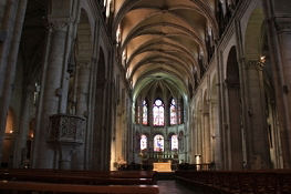
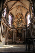
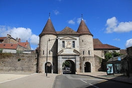
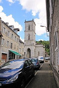
Am Morgen radeln wir zur Cathédrale Saint-Jean, um diese auch von Innen zu besichtigen. Danach verlassen wir die Stadt durch das Stadttor Porte Rivotte.
Information about copyright | |
|---|---|
Rights characteristic / license | by-sa: CREATIVE COMMONS Attribution-ShareAlike |
Link to the description of the license | |
taken over / edited on | 29 May 2014 - 10 Mar 2015
|
taken over / edited by |
|
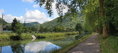
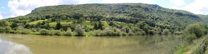
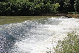
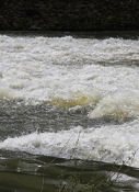
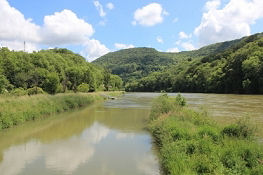
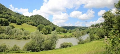
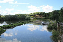
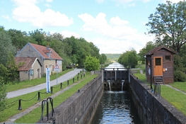
Der Radweg führt während des ganzen Tages fast ausschließlich nah am Canal bzw. dem Doubs entlang. Immer wieder ergeben sich schöne Ansichten vom Tal des Doubs.
Information about copyright | |
|---|---|
Rights characteristic / license | by-sa: CREATIVE COMMONS Attribution-ShareAlike |
Link to the description of the license | |
taken over / edited on | 29 May 2014 - 09 Mar 2015
|
taken over / edited by |
|
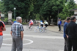
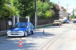
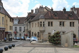
In Baume-les-Dames findet an diesem Sonntag ein Straßenrennen statt, wofür etliche der Straßen gesperrt sind. Der Ort ist schnell angesehen und hat nicht viel zu bieten.
Information about copyright | |
|---|---|
Rights characteristic / license | by-sa: CREATIVE COMMONS Attribution-ShareAlike |
Link to the description of the license | |
taken over / edited on | 29 May 2014 - 09 Mar 2015
|
taken over / edited by |
|
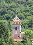
Viele der Kirchen an denen wir vorbei radelten sind mit einem Turmhelm mit farbig glasierten Kacheln, schön zu Ornamenten angeordnet, ausgestattet. Eine davon steht in Hyèvre-Paroisse.
Zweimal müssen wir im weiteren Verlauf ein kleines Stück den Berg hinauf: bei Roche-lès-Clerval (35 Hm) und bei Étouvans (60 Hm).
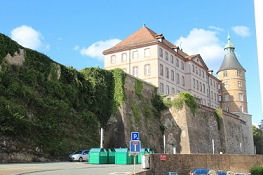
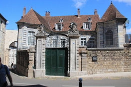
Am späten Nachmittag erreichen wir Montbéliard, dessen Hauptsehenswürdigkeit das Schloss ist. 400 Jahre regierten hier die Württemberger.
Information about copyright | |
|---|---|
Rights characteristic / license | by-sa: CREATIVE COMMONS Attribution-ShareAlike |
Link to the description of the license | |
taken over / edited on | 29 May 2014 - 10 Mar 2015
|
taken over / edited by |
|