
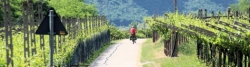
Adige Cycle Route
Actions
![]()
Please wait - map data are loading
Added on 04 Sep 2012,
last edited by biroto-Redaktion on 02 Nov 2023
Actions
Cycle route metrics
Total distance in km
223
Information about rights to the gps-track data | |
|---|---|
Rights owner | OpenStreetMap and Contributors + biroto-Redaktion (biroto.eu) |
Rights characteristic / license | Contains information from OpenStreetMap, which is made available here under the Open Database License(ODbL) |
Link to the description of the license | |
GPX file taken from | |
GPX file uploaded | by biroto-Redaktion on 02 Nov 2023
|
Track points in total
3.452
Track points per km (avg)
15
Start/endpoint
Start location
Curon Venosta, 32, IT (1501 m NHN)
End location
Brentino Belluno, 34, IT (121 m NHN)
Sources of information
Bücher:
- Esterbauer bikeline: Etsch-Radweg
Von Landeck nach Verona. Radtourenbuch, 345 km, 1:75.000, wetterfest/reißfest - Esterbauer bikeline: Radatlas Südtirol:
Radwandern im Eisacktal, Pustertal, Etschtal und im Vinschgau. Radtourenbuch 1:75.000
Travel reports about cycle tours
Information about copyright | |
|---|---|
Rights owner | |
Rights characteristic / license | by-sa: CREATIVE COMMONS Attribution-ShareAlike |
Link to the description of the license | |
Image has been uploaded | by ThimbleU on 01 Oct 2020
|
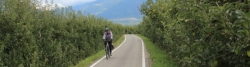
30 Sep 2012
75 km
A stage of the tour »Landeck - Naturns« of user ThimbleU
Information about copyright | |
|---|---|
Rights owner | |
Rights characteristic / license | © all rights reserved. |
Image has been uploaded | by Tandemteam-Traudel_und_Dieter on 04 Jan 2016
|
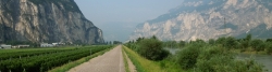
06 Jun 2015
67 km
A stage of the tour »Flecken nach Assisi« of user Tandemteam-Traudel_und_Dieter
Information about copyright | |
|---|---|
Rights owner | |
Rights characteristic / license | © all rights reserved. |
Image has been uploaded | by Tandemteam-Traudel_und_Dieter on 04 Jan 2016
|
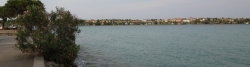
07 Jun 2015
102 km
A stage of the tour »Flecken nach Assisi« of user Tandemteam-Traudel_und_Dieter
19 May 2022
28 km
A stage of the tour »Northern Italy round trip part 1« of user ThimbleU
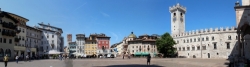
20 May 2022
75 km
A stage of the tour »Northern Italy round trip part 1« of user ThimbleU
Beds4Cyclists, worth visiting and infrastructure
Name and address
Latitude / Longitude
Phone
Fax
Mobile
Type of accommodation
Rating for cyclists
Route km
Dist. to route
Elevation
0 km
0,5 km
1.509 m
Hours of opening
Opening hours summer:
Monday - Saturday
From 9.00 a.m - 12.00 noon
and from 3.00 p.m. - 6.30 p.m.
Opening hours winter:
Monday – Saturday
From 9.00 a.m. – 12.00 noon
and from 2.30 p.m. – 6 p.m.
0 km
2,0 km
1.454 m
0 km
0,1 km
1.495 m
4 km
1,6 km
1.494 m
9 km
0,1 km
1.474 m
![]()