
Cycle Tour Fulda nach Lourdes
Tag 20: Capdenac - Cahors
![]()
Please wait - map data are loading
Added on 22 Dec 2013
last edited by Tandemteam-Traudel_und_Dieter on 04 Jan 2015
Cycle route metrics
ridden
Total distance in km
87
Cumulative elevation gain in m
1.892
Avg. slope uphill in %
2,17
Cumulative elevation loss in m
1.933
Total cycling hours
4,8
Avg. pace in km/h
18,1
Min. height
114
Max. height
324
Information about rights to the gps-track data | |
|---|---|
Rights owner | |
Rights characteristic / license | by-sa: CREATIVE COMMONS Attribution-ShareAlike |
Link to the description of the license | |
GPX file uploaded | by Tandemteam-Traudel_und_Dieter on 31 Dec 2013
|
Track points in total
543
Track points per km (avg)
6
Start/endpoint
Start location
Capdenac-Gare, Occitania, FR (173 m NHN)
End location
Cahors, Occitania, FR (132 m NHN)
ridden on
20 Jun 2007
Weather
Sonne
Properties
Nebenstraßen am Lot
Travel report
Information about copyright | |
|---|---|
Rights owner | |
Rights characteristic / license | © all rights reserved. |
Image has been uploaded | by Tandemteam-Traudel_und_Dieter on 04 Jan 2015
|
Information about copyright | |
|---|---|
Rights owner | |
Rights characteristic / license | © all rights reserved. |
Image has been uploaded | by Tandemteam-Traudel_und_Dieter on 04 Jan 2015
|
Information about copyright | |
|---|---|
Rights owner | |
Rights characteristic / license | © all rights reserved. |
Image has been uploaded | by Tandemteam-Traudel_und_Dieter on 04 Jan 2015
|
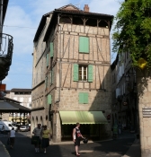
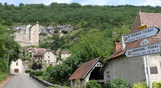
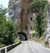
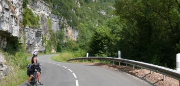
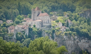
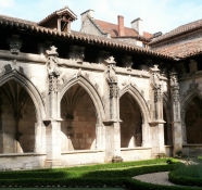
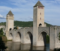
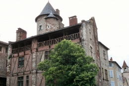
Der Anfang der Etappe war nicht so leicht. Dann ging es eben am Lot weiter, an Felswänden vorbei. Es ist ein sehr schönes Tal. Wieder Pilgerorte wie Figeac oder Cahors auf unserem Weg, in Saint-Géry legten wir eine Kaffeepause ein. In Cahors in der Jugendherberge zu zweit in einem 8 Bettenzimmer übernachtet, und ein gutes Frühstück am nächsten Morgen, nicht wie in Le Puy.
Information about copyright | |
|---|---|
Rights characteristic / license | by-sa: CREATIVE COMMONS Attribution-ShareAlike |
Link to the description of the license | |
taken over / edited on | 10 Dec 2014
|
taken over / edited by |
|
Information about copyright | |
|---|---|
Rights owner | |
Rights characteristic / license | © all rights reserved. |
Image has been uploaded | by Tandemteam-Traudel_und_Dieter on 04 Jan 2015
|
Information about copyright | |
|---|---|
Rights owner | |
Rights characteristic / license | © all rights reserved. |
Image has been uploaded | by Tandemteam-Traudel_und_Dieter on 04 Jan 2015
|
Information about copyright | |
|---|---|
Rights owner | |
Rights characteristic / license | © all rights reserved. |
Image has been uploaded | by Tandemteam-Traudel_und_Dieter on 04 Jan 2015
|
Information about copyright | |
|---|---|
Rights owner | |
Rights characteristic / license | © all rights reserved. |
Image has been uploaded | by Tandemteam-Traudel_und_Dieter on 04 Jan 2015
|
Information about copyright | |
|---|---|
Rights owner | |
Rights characteristic / license | © all rights reserved. |
Image has been uploaded | by Tandemteam-Traudel_und_Dieter on 04 Jan 2015
|