
Cycle Tour Hospental nach Basel
Travel report: Rheinradweg in der Schweiz
Actions
![]()
Please wait - map data are loading
Added on 09 Mar 2017,
last edited by Tandemteam-Traudel_und_Dieter on 15 Mar 2017
Actions
Cycle route metrics
planned
ridden
Total distance in km
451
461
Cumulative elevation gain in m
8.700
8.666
Avg. slope uphill in %
1,93
1,88
Cumulative elevation loss in m
9.939
9.870
Total cycling hours
-
30,3
Avg. pace in km/h
-
15,2
Information about rights to the gps-track data | |
|---|---|
Rights owner | |
Rights characteristic / license | by-sa: CREATIVE COMMONS Attribution-ShareAlike |
Link to the description of the license | |
GPX file uploaded | by Tandemteam-Traudel_und_Dieter on 09 Mar 2017
|
Track points in total
3.102
6.353
Track points per km (avg)
7
14
Start/endpoint
Start location
Hospental, Uri, CH (1504 m NHN)
End location
Basel, Basel-Stadt, CH (265 m NHN)
Character
Information about copyright | |
|---|---|
Rights characteristic / license | by-sa: CREATIVE COMMONS Attribution-ShareAlike |
Link to the description of the license | |
taken over / edited on | 09 Mar 2017 - 15 Mar 2017
|
taken over / edited by |
|
Landscape
Information about copyright | |
|---|---|
Rights characteristic / license | by-sa: CREATIVE COMMONS Attribution-ShareAlike |
Link to the description of the license | |
taken over / edited on | 09 Mar 2017
|
taken over / edited by |
|
Travel to and from ...
Mit der Bahn in Nehverkehrszügen.
Sources of information
Mit dem Routenführer vom Werd-Verlag
"Rhein-Route" Band 2
am Oberalppass gekauft
Veloland Schweiz
Connecting cycle path
1 Rhone-Route
3 Nord-Süd-Route
4 Alpenpanorama-Route
5 Mittelland-Route
6 Graubünden-Route
7 Jura-Route
8 Aare-Route
9 Seen-Route
Stages

Information about copyright | |
|---|---|
Rights owner | |
Rights characteristic / license | © all rights reserved. |
Image has been uploaded | by Tandemteam-Traudel_und_Dieter on 13 Mar 2017
|
Hinreise
Information about copyright | |
|---|---|
Rights owner | |
Rights characteristic / license | © all rights reserved. |
Image has been uploaded | by Tandemteam-Traudel_und_Dieter on 11 Mar 2017
|
45 km
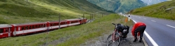
Hospental nach Surrein
Information about copyright | |
|---|---|
Rights owner | |
Rights characteristic / license | © all rights reserved. |
Image has been uploaded | by Tandemteam-Traudel_und_Dieter on 13 Mar 2017
|
61 km
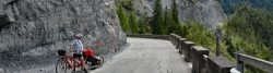
Surrein nach Chur
Information about copyright | |
|---|---|
Rights owner | |
Rights characteristic / license | © all rights reserved. |
Image has been uploaded | by Tandemteam-Traudel_und_Dieter on 13 Mar 2017
|
63 km
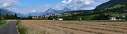
Chur nach Sennwald
Information about copyright | |
|---|---|
Rights owner | |
Rights characteristic / license | © all rights reserved. |
Image has been uploaded | by Tandemteam-Traudel_und_Dieter on 13 Mar 2017
|
71 km
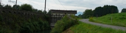
Sennwald nach Arbon
Information about copyright | |
|---|---|
Rights owner | |
Rights characteristic / license | © all rights reserved. |
Image has been uploaded | by Tandemteam-Traudel_und_Dieter on 14 Mar 2017
|
63 km
Arbon nach Stein am Rhein
Information about copyright | |
|---|---|
Rights owner | |
Rights characteristic / license | © all rights reserved. |
Image has been uploaded | by Tandemteam-Traudel_und_Dieter on 14 Mar 2017
|
47 km
Stein am Rhein nach Teufen
Information about copyright | |
|---|---|
Rights owner | |
Rights characteristic / license | © all rights reserved. |
Image has been uploaded | by Tandemteam-Traudel_und_Dieter on 14 Mar 2017
|
65 km
Teufen nach Stein AG
Information about copyright | |
|---|---|
Rights owner | |
Rights characteristic / license | © all rights reserved. |
Image has been uploaded | by Tandemteam-Traudel_und_Dieter on 14 Mar 2017
|
46 km
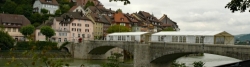
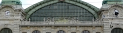
Stein AG nach Basel
Information about copyright | |
|---|---|
Rights owner | |
Rights characteristic / license | © all rights reserved. |
Image has been uploaded | by Tandemteam-Traudel_und_Dieter on 14 Mar 2017
|
Rückfahrt
Beds4Cyclists, worth visiting and infrastructure
Name and address
Latitude / Longitude
Phone
Fax
Mobile
Type of accommodation
Rating for cyclists
Route km
Dist. to route
Elevation
0 km
0,1 km
1.508 m
3 km
0,1 km
1.461 m
3 km
0,0 km
1.456 m
3 km
0,0 km
1.455 m
3 km
0,3 km
1.446 m
![]()