
Cycle Tour Bergisches Land - Siegerland - Westerwald - Taunus - Main
Berg-Dill: Wiehltal, Morsbach, Sieg mit Wissen und Betzdorf, Hellertal, Haiger
![]()
Please wait - map data are loading
Added on 03 Feb 2016
last edited by Rhino on 03 Feb 2016
Cycle route metrics
ridden
Total distance in km
82
Cumulative elevation gain in m
619
Avg. slope uphill in %
0,75
Cumulative elevation loss in m
533
Min. height
152
Max. height
438
Information about rights to the gps-track data | |
|---|---|
Rights owner | |
Rights characteristic / license | cc0: Public Domain no Rights reserved |
Link to the description of the license | |
GPX file uploaded | by InduKult on 03 Feb 2016
|
Track points in total
1.163
Track points per km (avg)
14
Start/endpoint
Start location
Wiehl, Nordrhein-Westfalen, DE (196 m NHN)
End location
Haiger, Hessen, DE (281 m NHN)
ridden on
19 Apr 2015
Weather
Sonne, schw. NO-Wind, 5 bis 17°
Unterkunft Hotel Reuter in Haiger
Properties
Drei-Länder-Pedelec-Tour Wiehl - Wisser Bach - (bis hierhin NRW) Sieg - Heller - (bis hierher Rheinland-Pfalz) Haiger an der Dill (Hessen), 82 km mit 600 m auf (7) in netto 5:20 (16 km/h), Sonne, schw. NO-Wind, 5 bis 17°
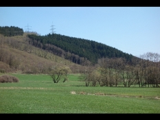
Richtung Südosten durch den Oberbergischen Kreis und das Rothaargebirge zur oberen Dill. Landschaftlich großartig, ähnliche offene und abwechslunsgreiche Landschaft sowie Industrie wie gestern. Ansonsten:
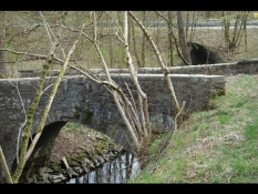
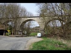
- Trasse der Wiehltalbahn mit Schienen und einigen Brücken sowie Tunnel Hülstert
- an der Sieg meist auf Radweg an der Hauptstraße, paar km neuer Weg
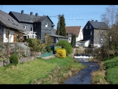
- hübsche Altstädte Morsbach, Wissen, Bielstein
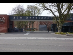
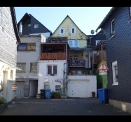
- Betzforf mit viel Beton verbaut
- Im Hellertal parallel zur reaktivierten Hellertalbahn (am Wochenende 2-Stunden-Takt) zuerst verbaut, im oberen Teil landschaftlich wunderbar mit Wiesen, Erlenbegleitung am Bachbett
- asymmetrische Wasserscheide zwischen Heller und Dill: im Hellertal stets sanft bergan, bis die Staße "Wasserscheide" selbige markiert; dann mit rauchenden Bremen steil abwärts nach Haiger
Unterkunft im Hotel Reuter; schwer etwas zu beißen zu finden.
Travel report
Information about copyright | |
|---|---|
Rights owner | |
Rights characteristic / license | by-sa: CREATIVE COMMONS Attribution-ShareAlike |
Link to the description of the license | |
Image has been uploaded | by InduKult on 03 Feb 2016
|
Information about copyright | |
|---|---|
Rights owner | |
Rights characteristic / license | by-sa: CREATIVE COMMONS Attribution-ShareAlike |
Link to the description of the license | |
Image has been uploaded | by InduKult on 03 Feb 2016
|
Information about copyright | |
|---|---|
Rights owner | |
Rights characteristic / license | by-sa: CREATIVE COMMONS Attribution-ShareAlike |
Link to the description of the license | |
Image has been uploaded | by InduKult on 03 Feb 2016
|
Information about copyright | |
|---|---|
Rights owner | |
Rights characteristic / license | by-sa: CREATIVE COMMONS Attribution-ShareAlike |
Link to the description of the license | |
Image has been uploaded | by InduKult on 03 Feb 2016
|
Information about copyright | |
|---|---|
Rights owner | |
Rights characteristic / license | by-sa: CREATIVE COMMONS Attribution-ShareAlike |
Link to the description of the license | |
Image has been uploaded | by InduKult on 03 Feb 2016
|
Information about copyright | |
|---|---|
Rights owner | |
Rights characteristic / license | by-sa: CREATIVE COMMONS Attribution-ShareAlike |
Link to the description of the license | |
Image has been uploaded | by InduKult on 03 Feb 2016
|
Information about copyright | |
|---|---|
Rights owner | |
Rights characteristic / license | by-sa: CREATIVE COMMONS Attribution-ShareAlike |
Link to the description of the license | |
Image has been uploaded | by InduKult on 03 Feb 2016
|