Cycle Tour Forchheim - Halle - Brunswick
4. Etappe: Hof - Walsburg
![]()
Please wait - map data are loading
Added on 19 Sep 2021
last edited by ThimbleU on 22 Nov 2021
Cycle route metrics
ridden
Total distance in km
84
Cumulative elevation gain in m
1.175
Avg. slope uphill in %
1,40
Cumulative elevation loss in m
1.355
Total cycling hours
5,5
Avg. pace in km/h
15,3
Min. height
256
Max. height
546
Information about rights to the gps-track data | |
|---|---|
Rights owner | |
Rights characteristic / license | cc0: Public Domain no Rights reserved |
Link to the description of the license | |
GPX file uploaded | by ThimbleU on 23 Sep 2021
|
Track points in total
1.888
Track points per km (avg)
22
Start/endpoint
Start location
Hof, Bayern, DE (508 m NHN)
End location
Eßbach, Thüringen, DE (328 m NHN)
ridden on
23 Sep 2021
Weather
Ganztägig wolkenlos, gegen 14:00 Uhr kräftige Winde aus westlichen Richtungen. 12 bis 21°C.
Accommodation
Landgasthof Fuchsbau
Walsburg 10
DE-07924 Eßbach
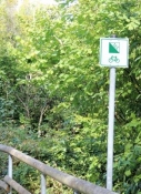
Signposting
Ab Hof bis Ziegenrück Logo des Saaleradweges an Punkten, an denen mehrere Radwege zusammentreffen und teilweise auch als Zwischenwegweiser. Im Wesentlichen allgemeines Radwegweisungsschild (grün). Für die Navigation ausreichend! |
|
|

Properties
| Firm surface (asphalt, concrete, …) smooth | 70,3 km | 83,5 % |
| Firm surface (cobblestone, asphalt bad, …) bumpy | 0,9 km | 1,1 % |
| Granular surface (compacted with self-binding gravel, …) rough | 4,8 km | 5,7 % |
| Granular surface (compacted with self-binding gravel, …) bumpy | 8,2 km | 9,7 % |
The information relates to the track as traveled!
Slope Gradient Distribution
Travel report
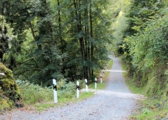
Am Rande der Altstadt wieder auf dem Saale-Radweg. In Sichtweite des Flusses talabwärts. Hinter Untertkotzau schlechte Obefläche, rumpelig und rutschig, aber landschaftlich schön durch Wiesen und Wald.
Vor der A72 eine Brücke mit Schiebvorrichtung, trotzdem schlecht mit dem vollgepackten Reiserad.
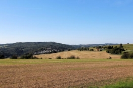
Ab Saalenstein beginnen die mit starken Anstiegen verbundenen Ausflüge auf die Höhen links und rechts des Saaletales. Von den Höhen immer wieder weite Blicke über die Landschaft und hinunter ins Saaletal.
Information about copyright | |
|---|---|
Rights characteristic / license | by-sa: CREATIVE COMMONS Attribution-ShareAlike |
Link to the description of the license | |
taken over / edited on | 17 Oct 2021 - 22 Nov 2021
|
taken over / edited by |
|
In Blankenstein wird der Aufstieg erschwert durch die winklige Wegführung bei gleichzeitig starken Anstiegen auf schmaler Trasse. Aber oben führt ein gut ausgebauter Radweg abseits der Straße bis kurz vor Harra.
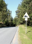
Vor dem Lemnitzhammer rolle ich dann bei 12% Steigung (lt. Straßenschild) hinunter ins Saaletaal.
Information about copyright | |
|---|---|
Rights characteristic / license | by-sa: CREATIVE COMMONS Attribution-ShareAlike |
Link to the description of the license | |
taken over / edited on | 17 Oct 2021
|
taken over / edited by |
|
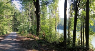
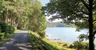
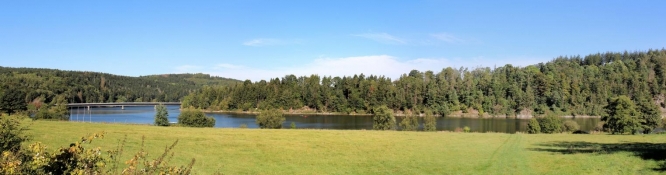
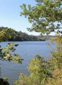
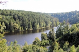
Danach beginnt der Weg entlang der Bleilochtalsperre. Zunächst höher im Uferwald, dann nah über dem Wasser, vor Saaldorf führt die Route über die Brücke über den Stausee. Der Stausee ist 28 km lang und mit 215 Millionen m3 Stauvolumen die größte Talsperre Deutschlands.
Information about copyright | |
|---|---|
Rights characteristic / license | by-sa: CREATIVE COMMONS Attribution-ShareAlike |
Link to the description of the license | |
taken over / edited on | 17 Oct 2021
|
taken over / edited by |
|
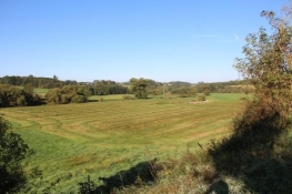
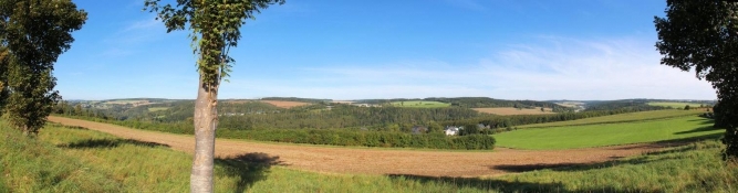
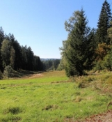
Hinter Saaldorf folgt ein langer Abschnitt durch Wald. Der erste Anstieg erfolgt auf schlechter Oberfläche im Wesentlichen entlang einer versteppten Waldwiese. Kurz nach dem höchsten Punkt beginnt eine Asphaltstraße, auf der ich den Berg wieder hinunterrolle bis fast auf Talsperrenniveau. Dabei viele schöne Eindrücke des Waldgebietes diesseits und jenseits des Tales. Danach aber folgt ein erneuter Anstieg, diesmal aber auf Asphalt und damit leichter zu fahren.
Information about copyright | |
|---|---|
Rights characteristic / license | by-sa: CREATIVE COMMONS Attribution-ShareAlike |
Link to the description of the license | |
taken over / edited on | 17 Oct 2021
|
taken over / edited by |
|
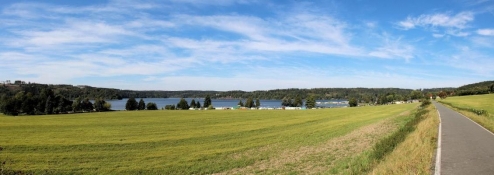
Dann rolle ich ein letzes Mal hinunter zur Bleilochtalsperre. Am nördlichen Ufer eines Seitenarmes radele ich eben dahin bis kurz vor Saalburg.
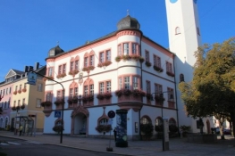
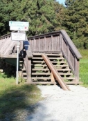
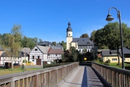
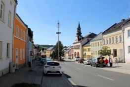
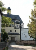
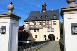
Für eine Runde durch die ehemalige Residenzstadt weiche ich vom Saaleradweg ab. Die Stadt ist geprägt vom Straßenmarkt. Am unteren Ende befindet sich eine Anlegestelle der Weißen Flotte auf der Bleilochtalsperre.
Information about copyright | |
|---|---|
Rights characteristic / license | by-sa: CREATIVE COMMONS Attribution-ShareAlike |
Link to the description of the license | |
taken over / edited on | 17 Oct 2021
|
taken over / edited by |
|
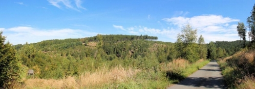
Kurz hinter Saalburg folgt der Radweg der ehemaligen Bahnstrecke, die für den Bau der Talsperre angelegt worden war. Mit gleichmäßiger Steigung radele ich für fast fünf Kilometer den Berg hinauf und für anderthalb Kilometer wieder hinunter.
Information about copyright | |
|---|---|
Rights characteristic / license | by-sa: CREATIVE COMMONS Attribution-ShareAlike |
Link to the description of the license | |
taken over / edited on | 17 Oct 2021
|
taken over / edited by |
|
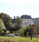
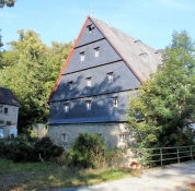
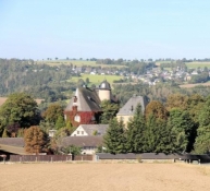
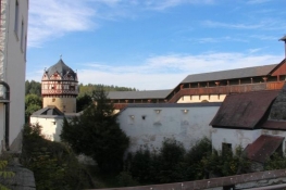
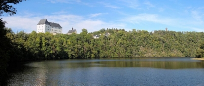
Nach weiteren drei Kilometern auf den Höhen und vorbei am Saaleturm rolle ich hinunter zum Schloss Burgk. Mit dem Rad gelange ich bis vor das Hauptgebäude. Von der Terrasse blickt man hinunter auf die Talsperre Burgkhammer. Und dorthin bringt mich auch der Radweg, der auf schmalem Pfad hinunterführt zur Staumauer.
Information about copyright | |
|---|---|
Rights characteristic / license | by-sa: CREATIVE COMMONS Attribution-ShareAlike |
Link to the description of the license | |
taken over / edited on | 17 Oct 2021
|
taken over / edited by |
|
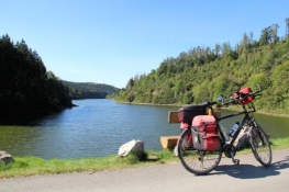
Nach Umrundung des Bergsporns bringt mich eine hölzerne Brücke über den Stausee Walsburg, dessen Ufer ich für knapp drei Kilometer folge, zwischendrin eine überraschender steiler Anstieg, an dessen Ende ich aus dem Sattel muss, weil gepflasterte Wasserabläufe endgültig den notwendigen Schwung für die Weiterfahrt nehmen.
Dann taucht am rechten Wegesrand ein Schild auf, das auf eine 16-prozentige Steigung hinweist. Ein frisch gebauter Weg mit Asphaltdecke windet sich mit zwei Spitzkehren 50 Meter den Berg hinauf.
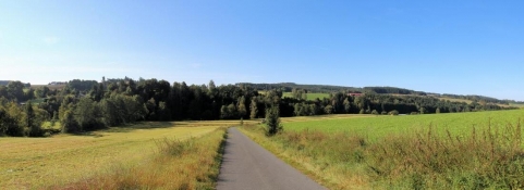
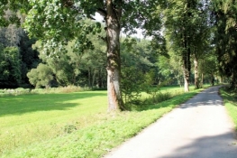
Sofort geht es auf Waldwegen die gewonnenen Höhenmeter wieder hinunter bis nach Walsburg. Hinter dem Ort beginnt eine schön verlaufende schmale Straße, die wenige Meter oberhalb der Saale eben über sieben Kilometer bis Ziegenrück verläuft.
Information about copyright | |
|---|---|
Rights characteristic / license | by-sa: CREATIVE COMMONS Attribution-ShareAlike |
Link to the description of the license | |
taken over / edited on | 17 Oct 2021
|
taken over / edited by |
|
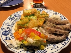
Da ich noch keine Unterkunft habe und es erst kurz nach fünfzehn Uhr ist, entschließe ich mich, noch bis Altenbeuthen weiterzufahren. Allerdings ist eine Unterkunft dort ausgebucht und die andere hat Betriebsferien. In Ziegenrück sind alle Unterkünfte ebenfalls ausgebucht. Schließlich finde ich ein Zimmer in Walsburg und darf die sieben Kilometer wieder zurückradeln. Zimmer gut, Essen gut, Ende gut.
Information about copyright | |
|---|---|
Rights characteristic / license | by-sa: CREATIVE COMMONS Attribution-ShareAlike |
Link to the description of the license | |
taken over / edited on | 17 Oct 2021
|
taken over / edited by |
|