
Cycle Tour Aachen - Vennbahn - Mosel - Saar - Mosel - Erft - Solingen
Tag 2: Monschau - Neuerburg
![]()
Please wait - map data are loading
Added on 19 Jul 2023
last edited by ThimbleU on 04 Oct 2023
Cycle route metrics
ridden
Total distance in km
100
Cumulative elevation gain in m
633
Avg. slope uphill in %
0,63
Cumulative elevation loss in m
725
Total cycling hours
5,7
Avg. pace in km/h
17,5
Min. height
327
Max. height
567
Information about rights to the gps-track data | |
|---|---|
Rights owner | |
Rights characteristic / license | cc0: Public Domain no Rights reserved |
Link to the description of the license | |
GPX file uploaded | by ThimbleU on 30 Aug 2023
|
Track points in total
1.592
Track points per km (avg)
16
Start/endpoint
Start location
Monschau, NW, DE (421 m NHN)
End location
Neuerburg, RP, DE (329 m NHN)
ridden on
05 Jul 2023
Weather
Bedeckt bis bewölkt, starker Wind aus Süd bis West (WS 5 bis 6), trocken. 12 bis 18°C.
Accommodation
euvea Freizeit- und Tagungshotel
Bitburger Straße 21
DE-54673 Neuerburg
Signposting
Auf dem Vennradweg Radweg Logo oder Ravel Richtungsweisung, zusätzlich Fahrbahnmarkierungen, für die Navigation ausreichend. |
|
Auf dem Eifel-Ardennen-Radweg Logo, für die Navigation ausreichend. |
|
Enztalradweg mit Logo, für die Navigation ausreichend. |
|


Slope Gradient Distribution
Travel report
Information about copyright | |
|---|---|
Rights owner | |
Rights characteristic / license | by-sa: CREATIVE COMMONS Attribution-ShareAlike |
Link to the description of the license | |
Image has been uploaded | by ThimbleU on 22 Aug 2023
|
Information about copyright | |
|---|---|
Rights owner | |
Rights characteristic / license | by-sa: CREATIVE COMMONS Attribution-ShareAlike |
Link to the description of the license | |
Image has been uploaded | by ThimbleU on 22 Aug 2023
|
Information about copyright | |
|---|---|
Rights owner | |
Rights characteristic / license | by-sa: CREATIVE COMMONS Attribution-ShareAlike |
Link to the description of the license | |
Image has been uploaded | by ThimbleU on 22 Aug 2023
|
Information about copyright | |
|---|---|
Rights owner | |
Rights characteristic / license | by-sa: CREATIVE COMMONS Attribution-ShareAlike |
Link to the description of the license | |
Image has been uploaded | by ThimbleU on 22 Aug 2023
|
Information about copyright | |
|---|---|
Rights owner | |
Rights characteristic / license | by-sa: CREATIVE COMMONS Attribution-ShareAlike |
Link to the description of the license | |
Image has been uploaded | by ThimbleU on 22 Aug 2023
|
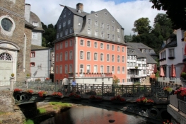
Nach einem guten Frühstück im gemütlichen Frühstücksraum unserer Unterkunft starten wir gegen 9:45 in die Tagesetappe.
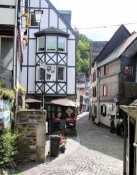
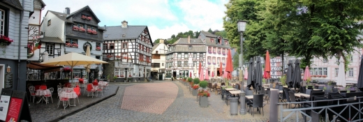
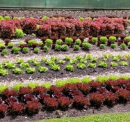
Zunächst fahren wir eine Runde durch die Stadt und schauen uns die Teile an, die wir gestern Abend nicht gesehen hatten.
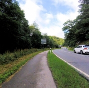
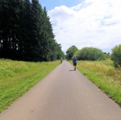
Dann radeln wir das Rurtal aufwärts aus der Stadt hinaus. Auf dem kurzen Stück an der Bundesstraße steht uns ein separater Radwegstreifen zur Verfügung.
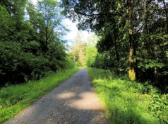
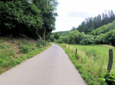
Dann biegen wir in den Reichensteiner Weg ein. Der führt und im Wald auf grobkörnigem Wegebau das Bachtal der Rur hinauf. Nach einem kurzen Stück Straße erreichen wir nahe des Klosters Reichenstein wieder die Vennbahntrasse.
Information about copyright | |
|---|---|
Rights characteristic / license | by-sa: CREATIVE COMMONS Attribution-ShareAlike |
Link to the description of the license | |
taken over / edited on | 22 Aug 2023 - 30 Aug 2023
|
taken over / edited by |
|
Information about copyright | |
|---|---|
Rights owner | |
Rights characteristic / license | by-sa: CREATIVE COMMONS Attribution-ShareAlike |
Link to the description of the license | |
Image has been uploaded | by ThimbleU on 22 Aug 2023
|
Information about copyright | |
|---|---|
Rights owner | |
Rights characteristic / license | by-sa: CREATIVE COMMONS Attribution-ShareAlike |
Link to the description of the license | |
Image has been uploaded | by ThimbleU on 22 Aug 2023
|
Information about copyright | |
|---|---|
Rights owner | |
Rights characteristic / license | by-sa: CREATIVE COMMONS Attribution-ShareAlike |
Link to the description of the license | |
Image has been uploaded | by ThimbleU on 22 Aug 2023
|
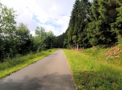
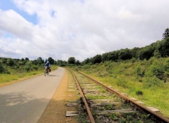
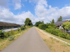
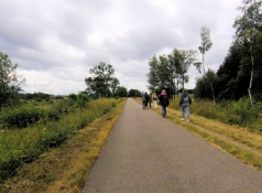
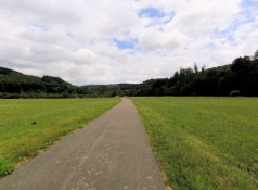
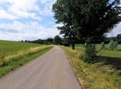
Wieder auf glattem Asphaltband unterwegs radeln wir flott den Anstieg hinauf bis nach Sourbrodt. Die Landschaft wird zunehmen offener und neben dem Radweg verläuft noch ein Eisenbahngleis. Hinter Sourbrodt können wir es für vier Kilometer leicht bergab laufen lassen.
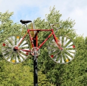
Am Ende des nächsten Anstiegs kommen wir an den Abzweig der Vennquerbahn bei Oberweywertz. Ein Fahrrad ist dort an einem Mast angebracht.
Information about copyright | |
|---|---|
Rights characteristic / license | by-sa: CREATIVE COMMONS Attribution-ShareAlike |
Link to the description of the license | |
taken over / edited on | 22 Aug 2023 - 30 Aug 2023
|
taken over / edited by |
|
Information about copyright | |
|---|---|
Rights owner | |
Rights characteristic / license | by-sa: CREATIVE COMMONS Attribution-ShareAlike |
Link to the description of the license | |
Image has been uploaded | by ThimbleU on 22 Aug 2023
|
Information about copyright | |
|---|---|
Rights owner | |
Rights characteristic / license | by-sa: CREATIVE COMMONS Attribution-ShareAlike |
Link to the description of the license | |
Image has been uploaded | by ThimbleU on 22 Aug 2023
|
Information about copyright | |
|---|---|
Rights owner | |
Rights characteristic / license | by-sa: CREATIVE COMMONS Attribution-ShareAlike |
Link to the description of the license | |
Image has been uploaded | by ThimbleU on 22 Aug 2023
|
Information about copyright | |
|---|---|
Rights owner | |
Rights characteristic / license | by-sa: CREATIVE COMMONS Attribution-ShareAlike |
Link to the description of the license | |
Image has been uploaded | by ThimbleU on 22 Aug 2023
|
Information about copyright | |
|---|---|
Rights owner | |
Rights characteristic / license | by-sa: CREATIVE COMMONS Attribution-ShareAlike |
Link to the description of the license | |
Image has been uploaded | by ThimbleU on 22 Aug 2023
|
Information about copyright | |
|---|---|
Rights owner | |
Rights characteristic / license | by-sa: CREATIVE COMMONS Attribution-ShareAlike |
Link to the description of the license | |
Image has been uploaded | by ThimbleU on 22 Aug 2023
|
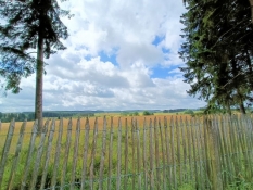
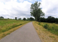
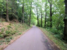
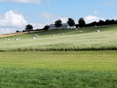
Für rund 13 Kilometer geht es 130 Höhenmeter hinab. Die Aussicht vom Radweg ist zwar offener als gestern. Aber der Nachteil der Bahnradwege ist doch eine gewisse Eintönigkeit.
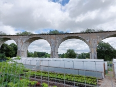
Am Bahnhof Born passieren wir die Freiherr von Korff-Brücke, über die früher die Bahnstrecke nach Vielsalm führte.
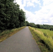
Drei Kilometer weiter endet auch dieser Anstieg und nach nochmals zwei Kilometern erreichen wir St. Vith. Die Durchfahrt durch das Stadtgebiet ist sicher gestaltet, verläuft aber teilweise abseits der ehemaligen Bahntrasse.
Auch hinter der Stadt radeln wir auf Nebenstraßen für vier Kilometer weiter. Die St.-Bartholomäus-Kapelle in Wiesenbach ist leider nur zugänglich, wenn man sich 400 Meter weiter den Schlüssel holt. Wir verzichten auf eine Besichtigung.
Information about copyright | |
|---|---|
Rights characteristic / license | by-sa: CREATIVE COMMONS Attribution-ShareAlike |
Link to the description of the license | |
taken over / edited on | 22 Aug 2023 - 30 Aug 2023
|
taken over / edited by |
|
Information about copyright | |
|---|---|
Rights owner | |
Rights characteristic / license | by-sa: CREATIVE COMMONS Attribution-ShareAlike |
Link to the description of the license | |
Image has been uploaded | by ThimbleU on 22 Aug 2023
|
Information about copyright | |
|---|---|
Rights owner | |
Rights characteristic / license | by-sa: CREATIVE COMMONS Attribution-ShareAlike |
Link to the description of the license | |
Image has been uploaded | by ThimbleU on 22 Aug 2023
|
Information about copyright | |
|---|---|
Rights owner | |
Rights characteristic / license | by-sa: CREATIVE COMMONS Attribution-ShareAlike |
Link to the description of the license | |
Image has been uploaded | by ThimbleU on 22 Aug 2023
|
Information about copyright | |
|---|---|
Rights owner | |
Rights characteristic / license | by-sa: CREATIVE COMMONS Attribution-ShareAlike |
Link to the description of the license | |
Image has been uploaded | by ThimbleU on 22 Aug 2023
|
Information about copyright | |
|---|---|
Rights owner | |
Rights characteristic / license | by-sa: CREATIVE COMMONS Attribution-ShareAlike |
Link to the description of the license | |
Image has been uploaded | by ThimbleU on 22 Aug 2023
|
Information about copyright | |
|---|---|
Rights owner | |
Rights characteristic / license | by-sa: CREATIVE COMMONS Attribution-ShareAlike |
Link to the description of the license | |
Image has been uploaded | by ThimbleU on 22 Aug 2023
|
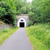
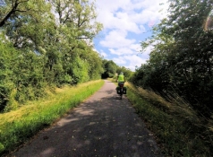
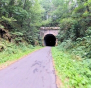
Kurz vor der Autobahnbrücke am Knotenpunkt 55 verlassen wir die Vennbahntrasse, ohne dass es uns bewusst wird. Jetzt sind wir auf der Trasse der ehemaligen Westeifelbahn, jetzt als Eifel-Ardennen-Radweg ebenfalls sehr gut ausgebaut. Bei Winterscheid geht es zur Abwechslung durch den 410 Meter langen Bleialfer-Tunnel.
Kurz vor Pronsfeld machen wir eine Spitzkehre auf die Trasse der ehemaligen Enztal-Bahn, jetzt Teil des Enztalradweges. Nach 1,3 Kilometern ist es dann wieder einmal vorbei mit dem Abwärtsradeln. Wegen des nicht mehr vorhandenen Bierbachtalviaduktes geht es gleich einmal zwanzig Höhenmeter steil mit rund 13% Steigung hinauf. Aber auch bis zum Scheitelpunkt zwischen Üttfeld und Arzfeld geht es ordentlich bergauf, es das Stück Bahntrasse mit der größten Steigung des heutigen Tages.
Information about copyright | |
|---|---|
Rights characteristic / license | by-sa: CREATIVE COMMONS Attribution-ShareAlike |
Link to the description of the license | |
taken over / edited on | 22 Aug 2023 - 30 Aug 2023
|
taken over / edited by |
|
Information about copyright | |
|---|---|
Rights owner | |
Rights characteristic / license | by-sa: CREATIVE COMMONS Attribution-ShareAlike |
Link to the description of the license | |
Image has been uploaded | by ThimbleU on 22 Aug 2023
|
Information about copyright | |
|---|---|
Rights owner | |
Rights characteristic / license | by-sa: CREATIVE COMMONS Attribution-ShareAlike |
Link to the description of the license | |
Image has been uploaded | by ThimbleU on 22 Aug 2023
|
Information about copyright | |
|---|---|
Rights owner | |
Rights characteristic / license | by-sa: CREATIVE COMMONS Attribution-ShareAlike |
Link to the description of the license | |
Image has been uploaded | by ThimbleU on 22 Aug 2023
|
Information about copyright | |
|---|---|
Rights owner | |
Rights characteristic / license | by-sa: CREATIVE COMMONS Attribution-ShareAlike |
Link to the description of the license | |
Image has been uploaded | by ThimbleU on 22 Aug 2023
|
Information about copyright | |
|---|---|
Rights owner | |
Rights characteristic / license | by-sa: CREATIVE COMMONS Attribution-ShareAlike |
Link to the description of the license | |
Image has been uploaded | by ThimbleU on 22 Aug 2023
|
Information about copyright | |
|---|---|
Rights owner | |
Rights characteristic / license | by-sa: CREATIVE COMMONS Attribution-ShareAlike |
Link to the description of the license | |
Image has been uploaded | by ThimbleU on 22 Aug 2023
|
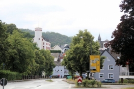
Auf den verbleibenden 15 Kilometern können wir bergab treten. Nach 40 Minuten erreichen wir Neuerburg. Auf der Straße radeln wir durch den Ort bis zu unserem Hotel und sind froh, nach 100 Kilometern am Ziel zu sein. An der Tür des telefonisch gebuchten Hotel erwartet uns jedoch eine schlechte Überraschung: "Wegen Krankheit heute geschlossen". Am Telefon heute Morgen gab es darauf noch gar keinen Hinweis. Wir versuchen es ein Hotel weiter und haben Glück. Wir treffen auf eine sehr freundliche und hilfsbereite Frau an der Rezeption. Das Zimmer ist umgehend klar gemacht. Die Fahrräder werden kurzerhand im Büro des Chefs eingeschlossen und wir steigen kurz darauf in unserem Zimmer in die Dusche.
Information about copyright | |
|---|---|
Rights characteristic / license | by-sa: CREATIVE COMMONS Attribution-ShareAlike |
Link to the description of the license | |
taken over / edited on | 23 Aug 2023 - 30 Aug 2023
|
taken over / edited by |
|
Information about copyright | |
|---|---|
Rights owner | |
Rights characteristic / license | by-sa: CREATIVE COMMONS Attribution-ShareAlike |
Link to the description of the license | |
Image has been uploaded | by ThimbleU on 22 Aug 2023
|
Information about copyright | |
|---|---|
Rights owner | |
Rights characteristic / license | by-sa: CREATIVE COMMONS Attribution-ShareAlike |
Link to the description of the license | |
Image has been uploaded | by ThimbleU on 22 Aug 2023
|
Information about copyright | |
|---|---|
Rights owner | |
Rights characteristic / license | by-sa: CREATIVE COMMONS Attribution-ShareAlike |
Link to the description of the license | |
Image has been uploaded | by ThimbleU on 23 Aug 2023
|
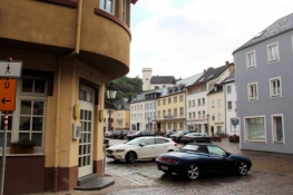
Zu Fuß laufen wir zum Abendessen zurück in die Stadt. Wie wir feststellen gibt es nur zwei Möglichkeiten. Der Italiener hat allerdings heute Ruhetag, so dass uns nur das Kebab-Pizza-Haus bleibt.
Information about copyright | |
|---|---|
Rights characteristic / license | by-sa: CREATIVE COMMONS Attribution-ShareAlike |
Link to the description of the license | |
taken over / edited on | 23 Aug 2023 - 30 Aug 2023
|
taken over / edited by |
|
Information about copyright | |
|---|---|
Rights owner | |
Rights characteristic / license | by-sa: CREATIVE COMMONS Attribution-ShareAlike |
Link to the description of the license | |
Image has been uploaded | by ThimbleU on 23 Aug 2023
|
Information about copyright | |
|---|---|
Rights owner | |
Rights characteristic / license | by-sa: CREATIVE COMMONS Attribution-ShareAlike |
Link to the description of the license | |
Image has been uploaded | by ThimbleU on 23 Aug 2023
|