
Cycle Tour Aachen - Vennbahn - Mosel - Saar - Mosel - Erft - Solingen
Tag 13: Trier - Mülheim
![]()
Please wait - map data are loading
Added on 19 Jul 2023
last edited by ThimbleU on 04 Oct 2023
Cycle route metrics
ridden
Total distance in km
64
Cumulative elevation gain in m
210
Avg. slope uphill in %
0,33
Cumulative elevation loss in m
241
Total cycling hours
3,5
Avg. pace in km/h
18,3
Min. height
103
Max. height
139
Information about rights to the gps-track data | |
|---|---|
Rights owner | |
Rights characteristic / license | cc0: Public Domain no Rights reserved |
Link to the description of the license | |
GPX file uploaded | by ThimbleU on 17 Jul 2023
|
Track points in total
834
Track points per km (avg)
13
Start/endpoint
Start location
Trier, RP, DE (136 m NHN)
End location
Mülheim an der Mosel, RP, DE (105 m NHN)
ridden on
16 Jul 2023
Weather
Sonnig bis bewölkt, trocken, überwiegend windstill. 22 bis 25°C.
Signposting
Logo des Moselradweges, für die Navigation ausreichend. Zwischenwegweisung mit allgemeinem Radwegweisungsschild (grün) und Bodenwegweisung. |
|
|


Slope Gradient Distribution
Travel report
Information about copyright | |
|---|---|
Rights owner | |
Rights characteristic / license | by-sa: CREATIVE COMMONS Attribution-ShareAlike |
Link to the description of the license | |
Image has been uploaded | by ThimbleU on 28 Aug 2023
|
Information about copyright | |
|---|---|
Rights owner | |
Rights characteristic / license | by-sa: CREATIVE COMMONS Attribution-ShareAlike |
Link to the description of the license | |
Image has been uploaded | by ThimbleU on 28 Aug 2023
|
Information about copyright | |
|---|---|
Rights owner | |
Rights characteristic / license | by-sa: CREATIVE COMMONS Attribution-ShareAlike |
Link to the description of the license | |
Image has been uploaded | by ThimbleU on 28 Aug 2023
|
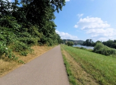
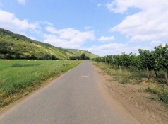
Für die ersten 1,2 Kilometer müssen wir uns mit den Autos auf Triers Straßen arrangieren. Dann sind wir wieder auf dem Mosel-Radweg am linken Moselufer. Direkt neben dem Fluss radeln wir bis Pfalzel. Danach führt die Route für sieben Kilometer durchs "Hinterland". Zunächst durch das Gewerbegebiet von Pfalzel, danach am Ortsrand von Ehrang entlang.
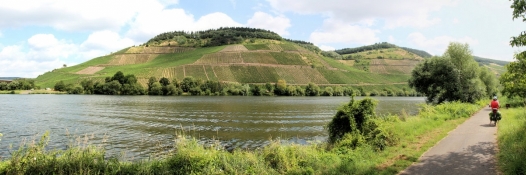
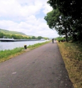
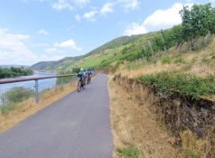
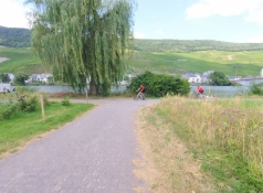
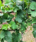
Weiter geht es direkt am Moselufer. In Schweich kommen wir am Yachthafen vorbei. Kurz darauf queren wir auf die andere Moselseite, die Wegführung am Südufer der Brücke ist hier schlecht gelöst. Ab jetzt sind fast immer Weinberge im Blickfeld. Bis Thörnich verläuft der Radweg nah am Ufer.
Information about copyright | |
|---|---|
Rights characteristic / license | by-sa: CREATIVE COMMONS Attribution-ShareAlike |
Link to the description of the license | |
taken over / edited on | 28 Aug 2023 - 01 Oct 2023
|
taken over / edited by |
|
Information about copyright | |
|---|---|
Rights owner | |
Rights characteristic / license | by-sa: CREATIVE COMMONS Attribution-ShareAlike |
Link to the description of the license | |
Image has been uploaded | by ThimbleU on 28 Aug 2023
|
Information about copyright | |
|---|---|
Rights owner | |
Rights characteristic / license | by-sa: CREATIVE COMMONS Attribution-ShareAlike |
Link to the description of the license | |
Image has been uploaded | by ThimbleU on 28 Aug 2023
|
Information about copyright | |
|---|---|
Rights owner | |
Rights characteristic / license | by-sa: CREATIVE COMMONS Attribution-ShareAlike |
Link to the description of the license | |
Image has been uploaded | by ThimbleU on 28 Aug 2023
|
Information about copyright | |
|---|---|
Rights owner | |
Rights characteristic / license | by-sa: CREATIVE COMMONS Attribution-ShareAlike |
Link to the description of the license | |
Image has been uploaded | by ThimbleU on 28 Aug 2023
|
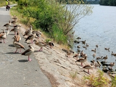
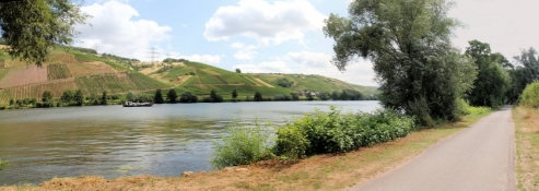
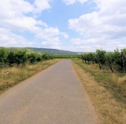
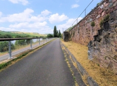
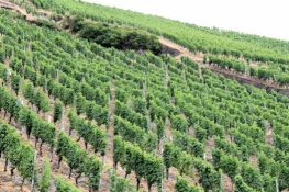
Hinter dem Ort geht es zur Umgehung der L48 in die Weinberge hinauf. Bevor es bei Köwerich wieder hinunter ans Ufer geht, haben wir uns 20 Höhenmeter hinauf pedaliert. Von Köwerich bis Leiwen verläuft der Radweg auf separatem Streifen neben der Landstraße. Hinter Leiwen radeln wir auf der ehemaligen Bahntrasse weiter. Die verläuft ein paar Meter oberhalb des Flussniveaus und wir genießen die schöne Aussicht über das Tal. Bilderbuch-Mosel! Am gegenüberliegenden Ufer liegt Trittenheim inmitten der Weinberge auf einer Landzunge an drei Seiten von der Mosel umflossen.
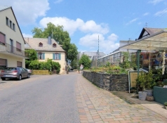
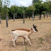
Gut einen Kilometer vor Neumagen hört die Bahntrasse auf. Es geht ein wenig hinauf in die Weinberge, kurz darauf zurück zur Landstraße und auf dieser durch den hübschen Weinort Neumagen. Zwischen Neumagen und Piesport kommen wir an einem Damwildgehege vorbei.
Information about copyright | |
|---|---|
Rights characteristic / license | by-sa: CREATIVE COMMONS Attribution-ShareAlike |
Link to the description of the license | |
taken over / edited on | 28 Aug 2023 - 01 Oct 2023
|
taken over / edited by |
|
Information about copyright | |
|---|---|
Rights owner | |
Rights characteristic / license | by-sa: CREATIVE COMMONS Attribution-ShareAlike |
Link to the description of the license | |
Image has been uploaded | by ThimbleU on 28 Aug 2023
|
Information about copyright | |
|---|---|
Rights owner | |
Rights characteristic / license | by-sa: CREATIVE COMMONS Attribution-ShareAlike |
Link to the description of the license | |
Image has been uploaded | by ThimbleU on 28 Aug 2023
|
Information about copyright | |
|---|---|
Rights owner | |
Rights characteristic / license | by-sa: CREATIVE COMMONS Attribution-ShareAlike |
Link to the description of the license | |
Image has been uploaded | by ThimbleU on 28 Aug 2023
|
Information about copyright | |
|---|---|
Rights owner | |
Rights characteristic / license | by-sa: CREATIVE COMMONS Attribution-ShareAlike |
Link to the description of the license | |
Image has been uploaded | by ThimbleU on 28 Aug 2023
|
Information about copyright | |
|---|---|
Rights owner | |
Rights characteristic / license | by-sa: CREATIVE COMMONS Attribution-ShareAlike |
Link to the description of the license | |
Image has been uploaded | by ThimbleU on 28 Aug 2023
|
Information about copyright | |
|---|---|
Rights owner | |
Rights characteristic / license | by-sa: CREATIVE COMMONS Attribution-ShareAlike |
Link to the description of the license | |
Image has been uploaded | by ThimbleU on 28 Aug 2023
|
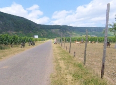
Durch die Weinberge fahren wir weiter nach Piesport und ab dort wieder am Moselufer entlang. Gegenüber von Minheim müssen wir wieder auf einem separaten Streifen neben der Straße radeln. Mehr Platz gibt das Gelände nicht her.
Hinter Wintrich sind wir wieder von der Straße weg und radeln auf Wirtschaftswegen am Rand von Weinfeldern nach Brauneberg.
Dort wird Weinfest gefeiert und wir müssen für einige Meter aus dem Sattel und durch die Menschenmenge schieben. Der letzte Kilometer des Tages führt durch Wiesen zu unserem Zielort Mülheim.
Ein landschaftlich sehr schöner Tourentag.
Information about copyright | |
|---|---|
Rights characteristic / license | by-sa: CREATIVE COMMONS Attribution-ShareAlike |
Link to the description of the license | |
taken over / edited on | 28 Aug 2023 - 01 Oct 2023
|
taken over / edited by |
|
Information about copyright | |
|---|---|
Rights owner | |
Rights characteristic / license | by-sa: CREATIVE COMMONS Attribution-ShareAlike |
Link to the description of the license | |
Image has been uploaded | by ThimbleU on 28 Aug 2023
|
Information about copyright | |
|---|---|
Rights owner | |
Rights characteristic / license | by-sa: CREATIVE COMMONS Attribution-ShareAlike |
Link to the description of the license | |
Image has been uploaded | by ThimbleU on 28 Aug 2023
|
Information about copyright | |
|---|---|
Rights owner | |
Rights characteristic / license | by-sa: CREATIVE COMMONS Attribution-ShareAlike |
Link to the description of the license | |
Image has been uploaded | by ThimbleU on 28 Aug 2023
|
Information about copyright | |
|---|---|
Rights owner | |
Rights characteristic / license | by-sa: CREATIVE COMMONS Attribution-ShareAlike |
Link to the description of the license | |
Image has been uploaded | by ThimbleU on 28 Aug 2023
|