
Cycle Tour Aachen - Vennbahn - Mosel - Saar - Mosel - Erft - Solingen
Tag 16: Kall - Bergheim
![]()
Please wait - map data are loading
Added on 19 Jul 2023
last edited by ThimbleU on 04 Oct 2023
Cycle route metrics
ridden
Total distance in km
74
Cumulative elevation gain in m
232
Avg. slope uphill in %
0,31
Cumulative elevation loss in m
567
Total cycling hours
4,5
Avg. pace in km/h
16,4
Min. height
64
Max. height
418
Information about rights to the gps-track data | |
|---|---|
Rights owner | |
Rights characteristic / license | cc0: Public Domain no Rights reserved |
Link to the description of the license | |
GPX file uploaded | by ThimbleU on 19 Jul 2023
|
Track points in total
1.223
Track points per km (avg)
17
Start/endpoint
Start location
Kall, NW, DE (402 m NHN)
End location
Bergheim, NW, DE (67 m NHN)
ridden on
19 Jul 2023
Weather
Bedeckt, gegen 10 Uhr für 6 Minuten leichter Regenschauer. 18 bis 24°C.
Accommodation
Hotel Meyer
Beisselstraße 3
DE-50126 Bergheim
Signposting
Von Kommern bis Euskirchen Logos der Radwege D4 und D7. Im Wesentlichen allgemeines Radwegweisungsschild (rot). |
|
| |
Von Euskirchen bis Bergheim Logo des Erft-Radweges. Im Wesentlichen allgemeines Radwegweisungsschild (rot). |
|
|


Slope Gradient Distribution
Travel report
Information about copyright | |
|---|---|
Rights owner | |
Rights characteristic / license | by-sa: CREATIVE COMMONS Attribution-ShareAlike |
Link to the description of the license | |
Image has been uploaded | by ThimbleU on 28 Aug 2023
|
Information about copyright | |
|---|---|
Rights owner | |
Rights characteristic / license | by-sa: CREATIVE COMMONS Attribution-ShareAlike |
Link to the description of the license | |
Image has been uploaded | by ThimbleU on 28 Aug 2023
|
Information about copyright | |
|---|---|
Rights owner | |
Rights characteristic / license | by-sa: CREATIVE COMMONS Attribution-ShareAlike |
Link to the description of the license | |
Image has been uploaded | by ThimbleU on 28 Aug 2023
|
Gestern Abend hatten wir unsere Fahrradlenker mit der Twist-Funktion um 90° gedreht um Platz zu sparen. An einem der Räder rastete heute Morgen der Lenker nicht in Normalstellung ein. Sicherheitsrisiko. Die Ursache war nicht klar. Deshalb fahren wir erst einmal zu einem Fahrradgeschäft. Dort kommt der Techniker aber erst am Nachmittag. Nach nochmaliger Untersuchung der Situation beschlossen wir, uns trotzdem auf den Weg zu machen.
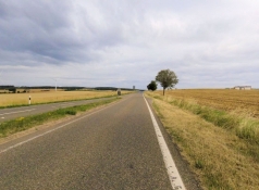
Zum Warmwerden fahren wir neben der Landstraße den Berg hinauf. Danach sind wir auf Nebenstraßen zwischen Felder unterwegs, es geht leicht bergab. Über uns ziehen dunkle Wolken auf und es wird windig. Dann ist der Schauer über uns. Nach sechs Minuten ist es aber schon wieder trocken. Der erste Regenschauer nach zwei Wochen Tour (und es war auch der einzige).
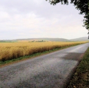
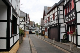
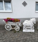
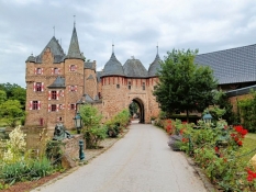
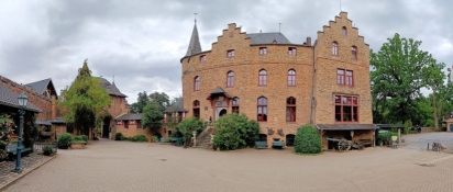
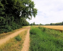
Am Kreisel vor Kommern treffen wir auf die Radwege D4/D7. Wenig später radeln wir durch die von Fachwerkhäusern gesäumte Straße in den Ort. Wir radeln die Kirchgasse hinauf nach St. Severinus. Die Kirche ist jedoch verschlossen. Hinter dem Ort fahren wir auf Nebenstraßen weiter durch Wiesen und Felder bis Firmenich. Hier biegen wir vom D4/d7 ab zu einem Abstecher nach Satzvey. Über einen kleinen Buckel führt die Straße. Die Wasserburg ist schnell gefunden. Der Zugang zum Burghof ist offen.
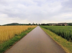
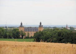
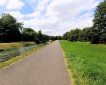
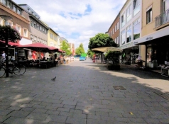
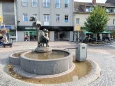
Auf dem Weg zurück zur Radroute sehen wir rechts unten im Veytal die Burg Veynau. Ein Stück neben der Bundesstraße und danach durch Wohnstraßen und Parks erreichen wir Euskirchen. Wir radeln und schieben eine Runde durch den Stadtkern. Dann wenden wir uns nordwärts zum Erft-Radweg, dem wir den Rest des Tages folgen.
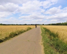
Das Gelände ist flach, der Radweg führt überwiegend nah an der Erft durch Felder und Wiesen, gelegentlich durch Buschland oder an kleinen Wäldern vorbei. Die Wegoberfläche ist, wenn nicht asphaltiert, nicht in gutem Zustand, das mag dem Starkregen und dem Hochwasser 2021 geschuldet sein.
Information about copyright | |
|---|---|
Rights characteristic / license | by-sa: CREATIVE COMMONS Attribution-ShareAlike |
Link to the description of the license | |
taken over / edited on | 28 Aug 2023 - 03 Oct 2023
|
taken over / edited by |
|
Information about copyright | |
|---|---|
Rights owner | |
Rights characteristic / license | by-sa: CREATIVE COMMONS Attribution-ShareAlike |
Link to the description of the license | |
Image has been uploaded | by ThimbleU on 28 Aug 2023
|
Information about copyright | |
|---|---|
Rights owner | |
Rights characteristic / license | by-sa: CREATIVE COMMONS Attribution-ShareAlike |
Link to the description of the license | |
Image has been uploaded | by ThimbleU on 28 Aug 2023
|
Information about copyright | |
|---|---|
Rights owner | |
Rights characteristic / license | by-sa: CREATIVE COMMONS Attribution-ShareAlike |
Link to the description of the license | |
Image has been uploaded | by ThimbleU on 28 Aug 2023
|
Information about copyright | |
|---|---|
Rights owner | |
Rights characteristic / license | by-sa: CREATIVE COMMONS Attribution-ShareAlike |
Link to the description of the license | |
Image has been uploaded | by ThimbleU on 28 Aug 2023
|
Information about copyright | |
|---|---|
Rights owner | |
Rights characteristic / license | by-sa: CREATIVE COMMONS Attribution-ShareAlike |
Link to the description of the license | |
Image has been uploaded | by ThimbleU on 28 Aug 2023
|
Information about copyright | |
|---|---|
Rights owner | |
Rights characteristic / license | by-sa: CREATIVE COMMONS Attribution-ShareAlike |
Link to the description of the license | |
Image has been uploaded | by ThimbleU on 28 Aug 2023
|
Information about copyright | |
|---|---|
Rights owner | |
Rights characteristic / license | by-sa: CREATIVE COMMONS Attribution-ShareAlike |
Link to the description of the license | |
Image has been uploaded | by ThimbleU on 28 Aug 2023
|
Information about copyright | |
|---|---|
Rights owner | |
Rights characteristic / license | by-sa: CREATIVE COMMONS Attribution-ShareAlike |
Link to the description of the license | |
Image has been uploaded | by ThimbleU on 28 Aug 2023
|
Bei Erftstadt-Blessem ist der Radweg gesperrt. Wir suchen uns einen Weg westlich der Erft zur Umgehung. Wie ich später feststellte, betrifft die Sperrung das Gebiet von Erftstadt, in dem die in den Fernsehbildern bekannt gewordene Sandgrube liegt, deren Ufer durch das Hochwasser in erheblichen Maße abgetragen wurden.
Das Landschaftsbild ändert sich wenig. Die Oberfläche des Radweges wird ab Gymnich aber deutlich besser.
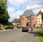
Eine Stunde später kommen wir in Erftstadt an. Durch das Aachener Tor kommen wir in den Stadtkern. Wenig weiter erreichen wir unser Hotel. Die Fahrräder kommen in einem verschlossenen Funktionsraum des Hotels unter und wir bekommen wieder ein Apartment.
Information about copyright | |
|---|---|
Rights characteristic / license | by-sa: CREATIVE COMMONS Attribution-ShareAlike |
Link to the description of the license | |
taken over / edited on | 28 Aug 2023 - 03 Oct 2023
|
taken over / edited by |
|
Information about copyright | |
|---|---|
Rights owner | |
Rights characteristic / license | by-sa: CREATIVE COMMONS Attribution-ShareAlike |
Link to the description of the license | |
Image has been uploaded | by ThimbleU on 28 Aug 2023
|
Information about copyright | |
|---|---|
Rights owner | |
Rights characteristic / license | by-sa: CREATIVE COMMONS Attribution-ShareAlike |
Link to the description of the license | |
Image has been uploaded | by ThimbleU on 28 Aug 2023
|
Information about copyright | |
|---|---|
Rights owner | |
Rights characteristic / license | by-sa: CREATIVE COMMONS Attribution-ShareAlike |
Link to the description of the license | |
Image has been uploaded | by ThimbleU on 28 Aug 2023
|