Cycle Tour Bike holiday in the Alps 2014
Dag 11, etape/stage 8: Tegernsee-München
![]()
Please wait - map data are loading
Added on 05 Aug 2014
last edited by Ottocolor on 14 Aug 2014
Cycle route metrics
ridden
Total distance in km
67
Cumulative elevation gain in m
307
Avg. slope uphill in %
0,46
Cumulative elevation loss in m
500
Min. height
520
Max. height
771
Information about rights to the gps-track data | |
|---|---|
Rights owner | |
Rights characteristic / license | by-sa: CREATIVE COMMONS Attribution-ShareAlike |
Link to the description of the license | |
GPX file uploaded | by Ottocolor on 09 Aug 2014
|
Track points in total
1.155
Track points per km (avg)
17
Start/endpoint
Start location
Kreuth, Bayern, DE (727 m NHN)
End location
München, Bayern, DE (520 m NHN)
ridden on
31 Jul 2014
Weather
Rain in the morning until about noon. Then overcast for some time. Later i brightened up with a lot of sun. Light winds and especially late in the day with pleasant temperatures.
Accommodation
Campingplatz Thalkirchen
Zentralländstraße 49
DE-81379 München
Properties
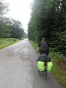
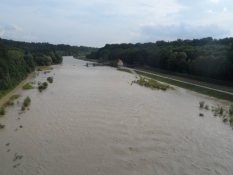
First a dangerous, heavily trafficed road through Rottach-Egern and Tegernsee. Then tarmac bike paths to Gmund and from there on small, tortuous roads up to Holzkirchen. Through the town in the traffic. Then follows a beautiful, easy stretch through a big forest followed by longer stretches on gravel, most of them good, but some a quite bumpy. The last parts are again good on tarmac along railways and the river Isar in Munich's excellent bike path system. Poor signposting. I was happy to rely on the gps guidance today.
Slope Gradient Distribution
Remarks
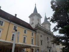
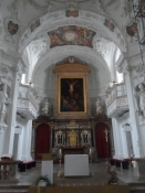
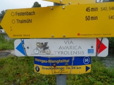
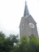
The last cycling stage to our final goal of Munich. A short stop at the benedictine abbey at Tegernsee. We followed the reasonably well signposted bike route of Via Bavarica Tyrolensis to Munichs spacious camp site, 7 km south of the city centre.
Travel report
Information about copyright | |
|---|---|
Rights owner | |
Rights characteristic / license | by-sa: CREATIVE COMMONS Attribution-ShareAlike |
Link to the description of the license | |
Image has been uploaded | by Ottocolor on 14 Aug 2014
|
Information about copyright | |
|---|---|
Rights owner | |
Rights characteristic / license | by-sa: CREATIVE COMMONS Attribution-ShareAlike |
Link to the description of the license | |
Image has been uploaded | by Ottocolor on 14 Aug 2014
|
Information about copyright | |
|---|---|
Rights owner | |
Rights characteristic / license | by-sa: CREATIVE COMMONS Attribution-ShareAlike |
Link to the description of the license | |
Image has been uploaded | by Ottocolor on 14 Aug 2014
|
Information about copyright | |
|---|---|
Rights owner | |
Rights characteristic / license | by-sa: CREATIVE COMMONS Attribution-ShareAlike |
Link to the description of the license | |
Image has been uploaded | by Ottocolor on 14 Aug 2014
|
Information about copyright | |
|---|---|
Rights owner | |
Rights characteristic / license | by-sa: CREATIVE COMMONS Attribution-ShareAlike |
Link to the description of the license | |
Image has been uploaded | by Ottocolor on 14 Aug 2014
|
Information about copyright | |
|---|---|
Rights owner | |
Rights characteristic / license | by-sa: CREATIVE COMMONS Attribution-ShareAlike |
Link to the description of the license | |
Image has been uploaded | by Ottocolor on 14 Aug 2014
|
Information about copyright | |
|---|---|
Rights owner | |
Rights characteristic / license | by-sa: CREATIVE COMMONS Attribution-ShareAlike |
Link to the description of the license | |
Image has been uploaded | by Ottocolor on 14 Aug 2014
|
Information about copyright | |
|---|---|
Rights owner | |
Rights characteristic / license | by-sa: CREATIVE COMMONS Attribution-ShareAlike |
Link to the description of the license | |
Image has been uploaded | by Ottocolor on 14 Aug 2014
|
Information about copyright | |
|---|---|
Rights owner | |
Rights characteristic / license | by-sa: CREATIVE COMMONS Attribution-ShareAlike |
Link to the description of the license | |
Image has been uploaded | by Ottocolor on 14 Aug 2014
|
Information about copyright | |
|---|---|
Rights owner | |
Rights characteristic / license | by-sa: CREATIVE COMMONS Attribution-ShareAlike |
Link to the description of the license | |
Image has been uploaded | by Ottocolor on 14 Aug 2014
|
Information about copyright | |
|---|---|
Rights owner | |
Rights characteristic / license | by-sa: CREATIVE COMMONS Attribution-ShareAlike |
Link to the description of the license | |
Image has been uploaded | by Ottocolor on 14 Aug 2014
|
Information about copyright | |
|---|---|
Rights owner | |
Rights characteristic / license | by-sa: CREATIVE COMMONS Attribution-ShareAlike |
Link to the description of the license | |
Image has been uploaded | by Ottocolor on 14 Aug 2014
|

