
Cycle Tour Fulda nach Lourdes
Tag 16: Le Chambon - Le Puy
![]()
Please wait - map data are loading
Added on 22 Dec 2013
last edited by Tandemteam-Traudel_und_Dieter on 06 Jan 2015
Cycle route metrics
ridden
Total distance in km
29
Cumulative elevation gain in m
824
Avg. slope uphill in %
2,84
Cumulative elevation loss in m
711
Total cycling hours
1,7
Avg. pace in km/h
17,1
Min. height
529
Max. height
693
Information about rights to the gps-track data | |
|---|---|
Rights owner | |
Rights characteristic / license | by-sa: CREATIVE COMMONS Attribution-ShareAlike |
Link to the description of the license | |
GPX file uploaded | by Tandemteam-Traudel_und_Dieter on 30 Dec 2013
|
Track points in total
213
Track points per km (avg)
7
Start/endpoint
Start location
Chamalières-sur-Loire, Auvergne-Rhône-Alpes, FR (531 m NHN)
End location
Le Puy-en-Velay, Auvergne-Rhône-Alpes, FR (644 m NHN)
ridden on
16 Jun 2007
Weather
Sonne
Properties
Nebenstraßen
Travel report
Information about copyright | |
|---|---|
Rights owner | |
Rights characteristic / license | © all rights reserved. |
Image has been uploaded | by Tandemteam-Traudel_und_Dieter on 02 Jan 2015
|
Information about copyright | |
|---|---|
Rights owner | |
Rights characteristic / license | © all rights reserved. |
Image has been uploaded | by Tandemteam-Traudel_und_Dieter on 03 Jan 2015
|
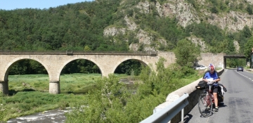
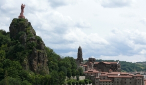
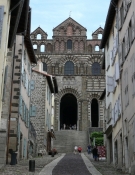
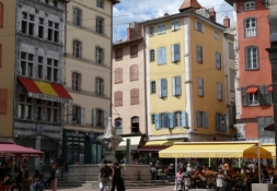
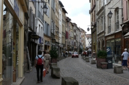
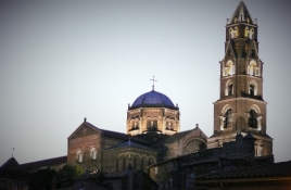
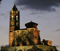
Heute eine kurze Etappe, weil wir in Le Puy bleiben wollen. Übernachtung ist in der Jugendherberge im Fünf-Bett-Zimmer. Der heutige Tag ist lang durch die Besichtigungen. Le Puy ist eine sehr bekannte Pilgerstadt und Ausgangspunkt für den Jakobsweg Via Podiensis nach Saint-Jean-Piet-de-Port in den Pyrenäen.
Information about copyright | |
|---|---|
Rights characteristic / license | by-sa: CREATIVE COMMONS Attribution-ShareAlike |
Link to the description of the license | |
taken over / edited on | 09 Dec 2014
|
taken over / edited by |
|
Information about copyright | |
|---|---|
Rights owner | |
Rights characteristic / license | © all rights reserved. |
Image has been uploaded | by Tandemteam-Traudel_und_Dieter on 06 Jan 2015
|
Information about copyright | |
|---|---|
Rights owner | |
Rights characteristic / license | © all rights reserved. |
Image has been uploaded | by Tandemteam-Traudel_und_Dieter on 06 Jan 2015
|
Information about copyright | |
|---|---|
Rights owner | |
Rights characteristic / license | © all rights reserved. |
Image has been uploaded | by Tandemteam-Traudel_und_Dieter on 03 Jan 2015
|
Information about copyright | |
|---|---|
Rights owner | |
Rights characteristic / license | © all rights reserved. |
Image has been uploaded | by Tandemteam-Traudel_und_Dieter on 03 Jan 2015
|
Information about copyright | |
|---|---|
Rights owner | |
Rights characteristic / license | © all rights reserved. |
Image has been uploaded | by Tandemteam-Traudel_und_Dieter on 03 Jan 2015
|
Information about copyright | |
|---|---|
Rights owner | |
Rights characteristic / license | © all rights reserved. |
Image has been uploaded | by Tandemteam-Traudel_und_Dieter on 03 Jan 2015
|