
EuroVelo: Ostseeküstenradweg
Nr. des Radweges EV10
Aktionen
![]()
Bitte warten - Kartendaten werden geladen
Erstellt am 05.10.2011,
zuletzt geändert von biroto-Redaktion am 29.03.2024
Aktionen
Strecken-Merkmale
Gesamtlänge in km
8.451
Informationen zu Rechten an den GPS-Track-Daten | |
|---|---|
Rechte-Inhaber | OpenStreetMap and Contributors + biroto-Redaktion (biroto.eu) |
Rechte-Ausprägung / Lizenz | Enthält Daten von OpenStreetMap, die hier unter der Open Database License(ODbL) verfügbar gemacht werden |
Link zur Rechtebeschreibung | |
gpx-Datei übernommen aus | |
gpx-Datei hochgeladen | durch biroto-Redaktion am 29.03.2024
|
Gesamtzahl Trackpoints
113.833
Trackpoint-Dichte per km
13
Endorte
Start
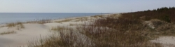
Lappeenranta, FI (48 m NHN)
Ziel
Ивангородское городское поселение, Ленинградская область, RU (17 m NHN)
Wegweisung
In Estonia |
|
In Deutschland |
|


Informations-Quellen
Portale:
Bücher/Karten:
- Esterbauer bikeline: Ostseeküsten-Radweg
Teil 1: Schleswig-Holstein. Von Flensburg nach Lübeck. 1:75.000, wetterfest/reißfest - Esterbauer bikeline: Ostseeküsten-Radweg
Teil 2: Mecklenburg-Vorpommern. Von Lübeck nach Ahlbeck/Usedom mit Rügen, 690 km, 1:50.000, wetterfest/reißfest - Esterbauer bikeline: Ostseeküsten-Radweg
Teil 3: Polen. Von Ahlbeck/Usedom nach Danzig. 1:75.000, wetterfest/reißfest - Detlef Kaden: Berlin - Stettin - Danzig - Marienburg
Ein Radreiseführer: ready to go: Tourguide, Karten - Esterbauer bikeline: Ostseeküste Baltikum (Riga-Tallinn)
Bemerkungen
Für den Ostseeküstenradweg sind für folgende Länder die Abschnitte auch als eigenständige Routen verfügbar:
Für die Lücke in Russland siehe
Die Grenzübergänge zwischen Finnland und Russland in Nuijamaa (Lappeenranta) wie auch in Vaalimaa sind seit Nov. 2023 gesperrt!
Reiseberichte über Fahrradtouren
Informationen zu Urheber-Rechten | |
|---|---|
Rechte-Inhaber | |
Rechte-Ausprägung / Lizenz | by-sa: CREATIVE COMMONS Namensnennung, Weitergabe unter gleichen Bedingungen |
Link zur Rechtebeschreibung | |
Bild hochgeladen | durch Ottocolor am 18.06.2023
|
22.05.2023
5 km
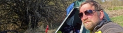
Eine Etappe der Tour »Eiserner Vorhang Tour, Teil 3 Gdingen-Asch« von Anwender Ottocolor
Informationen zu Urheber-Rechten | |
|---|---|
Rechte-Inhaber | |
Rechte-Ausprägung / Lizenz | by-sa: CREATIVE COMMONS Namensnennung, Weitergabe unter gleichen Bedingungen |
Link zur Rechtebeschreibung | |
Bild hochgeladen | durch Ottocolor am 18.06.2023
|
21.05.2023
58 km
Eine Etappe der Tour »Eiserner Vorhang Tour, Teil 3 Gdingen-Asch« von Anwender Ottocolor
Informationen zu Urheber-Rechten | |
|---|---|
Rechte-Inhaber | |
Rechte-Ausprägung / Lizenz | by-sa: CREATIVE COMMONS Namensnennung, Weitergabe unter gleichen Bedingungen |
Link zur Rechtebeschreibung | |
Bild hochgeladen | durch Ottocolor am 18.06.2023
|
20.05.2023
47 km
Eine Etappe der Tour »Eiserner Vorhang Tour, Teil 3 Gdingen-Asch« von Anwender Ottocolor
Informationen zu Urheber-Rechten | |
|---|---|
Rechte-Inhaber | |
Rechte-Ausprägung / Lizenz | by-sa: CREATIVE COMMONS Namensnennung, Weitergabe unter gleichen Bedingungen |
Link zur Rechtebeschreibung | |
Bild hochgeladen | durch Ottocolor am 18.06.2023
|
19.05.2023
79 km
Eine Etappe der Tour »Eiserner Vorhang Tour, Teil 3 Gdingen-Asch« von Anwender Ottocolor
Informationen zu Urheber-Rechten | |
|---|---|
Rechte-Inhaber | |
Rechte-Ausprägung / Lizenz | by-sa: CREATIVE COMMONS Namensnennung, Weitergabe unter gleichen Bedingungen |
Link zur Rechtebeschreibung | |
Bild hochgeladen | durch Ottocolor am 18.06.2023
|
18.05.2023
65 km
Eine Etappe der Tour »Eiserner Vorhang Tour, Teil 3 Gdingen-Asch« von Anwender Ottocolor
Informationen zu Urheber-Rechten | |
|---|---|
Rechte-Inhaber | |
Rechte-Ausprägung / Lizenz | by-sa: CREATIVE COMMONS Namensnennung, Weitergabe unter gleichen Bedingungen |
Link zur Rechtebeschreibung | |
Bild hochgeladen | durch Ottocolor am 18.06.2023
|
17.05.2023
71 km
Eine Etappe der Tour »Eiserner Vorhang Tour, Teil 3 Gdingen-Asch« von Anwender Ottocolor
Informationen zu Urheber-Rechten | |
|---|---|
Rechte-Inhaber | |
Rechte-Ausprägung / Lizenz | by-sa: CREATIVE COMMONS Namensnennung, Weitergabe unter gleichen Bedingungen |
Link zur Rechtebeschreibung | |
Bild hochgeladen | durch Ottocolor am 18.06.2023
|
16.05.2023
49 km
Eine Etappe der Tour »Eiserner Vorhang Tour, Teil 3 Gdingen-Asch« von Anwender Ottocolor
Informationen zu Urheber-Rechten | |
|---|---|
Rechte-Inhaber | |
Rechte-Ausprägung / Lizenz | by-sa: CREATIVE COMMONS Namensnennung, Weitergabe unter gleichen Bedingungen |
Link zur Rechtebeschreibung | |
Bild hochgeladen | durch Ottocolor am 18.06.2023
|
14.05.2023
74 km
Eine Etappe der Tour »Eiserner Vorhang Tour, Teil 3 Gdingen-Asch« von Anwender Ottocolor
Informationen zu Urheber-Rechten | |
|---|---|
Rechte-Inhaber | |
Rechte-Ausprägung / Lizenz | by-sa: CREATIVE COMMONS Namensnennung, Weitergabe unter gleichen Bedingungen |
Link zur Rechtebeschreibung | |
Bild hochgeladen | durch Ottocolor am 18.06.2023
|
13.05.2023
78 km
Eine Etappe der Tour »Eiserner Vorhang Tour, Teil 3 Gdingen-Asch« von Anwender Ottocolor
Informationen zu Urheber-Rechten | |
|---|---|
Rechte-Inhaber | |
Rechte-Ausprägung / Lizenz | by-sa: CREATIVE COMMONS Namensnennung, Weitergabe unter gleichen Bedingungen |
Link zur Rechtebeschreibung | |
Bild hochgeladen | durch Ottocolor am 18.06.2023
|
12.05.2023
88 km
Eine Etappe der Tour »Eiserner Vorhang Tour, Teil 3 Gdingen-Asch« von Anwender Ottocolor
Informationen zu Urheber-Rechten | |
|---|---|
Rechte-Inhaber | |
Rechte-Ausprägung / Lizenz | by-sa: CREATIVE COMMONS Namensnennung, Weitergabe unter gleichen Bedingungen |
Link zur Rechtebeschreibung | |
Bild hochgeladen | durch Ottocolor am 18.06.2023
|
11.05.2023
43 km
Eine Etappe der Tour »Eiserner Vorhang Tour, Teil 3 Gdingen-Asch« von Anwender Ottocolor
Informationen zu Urheber-Rechten | |
|---|---|
Rechte-Inhaber | |
Rechte-Ausprägung / Lizenz | by-sa: CREATIVE COMMONS Namensnennung, Weitergabe unter gleichen Bedingungen |
Link zur Rechtebeschreibung | |
Bild hochgeladen | durch Ottocolor am 18.06.2023
|
10.05.2023
61 km
Eine Etappe der Tour »Eiserner Vorhang Tour, Teil 3 Gdingen-Asch« von Anwender Ottocolor
Informationen zu Urheber-Rechten | |
|---|---|
Rechte-Inhaber | |
Rechte-Ausprägung / Lizenz | by-sa: CREATIVE COMMONS Namensnennung, Weitergabe unter gleichen Bedingungen |
Link zur Rechtebeschreibung | |
Bild hochgeladen | durch Ottocolor am 18.06.2023
|
09.05.2023
81 km
Eine Etappe der Tour »Eiserner Vorhang Tour, Teil 3 Gdingen-Asch« von Anwender Ottocolor
Informationen zu Urheber-Rechten | |
|---|---|
Rechte-Inhaber | |
Rechte-Ausprägung / Lizenz | by-sa: CREATIVE COMMONS Namensnennung, Weitergabe unter gleichen Bedingungen |
Link zur Rechtebeschreibung | |
Bild hochgeladen | durch Ottocolor am 03.07.2017
|
05.05.2017
82 km
Eine Etappe der Tour »Radtour Eiserner Vorhang, Teil 1: Klaipeda-Grense Jakobselv« von Anwender Ottocolor
Informationen zu Urheber-Rechten | |
|---|---|
Rechte-Inhaber | |
Rechte-Ausprägung / Lizenz | by-sa: CREATIVE COMMONS Namensnennung, Weitergabe unter gleichen Bedingungen |
Link zur Rechtebeschreibung | |
Bild hochgeladen | durch Ottocolor am 03.07.2017
|
06.05.2017
58 km
Eine Etappe der Tour »Radtour Eiserner Vorhang, Teil 1: Klaipeda-Grense Jakobselv« von Anwender Ottocolor
Informationen zu Urheber-Rechten | |
|---|---|
Rechte-Inhaber | |
Rechte-Ausprägung / Lizenz | by-sa: CREATIVE COMMONS Namensnennung, Weitergabe unter gleichen Bedingungen |
Link zur Rechtebeschreibung | |
Bild hochgeladen | durch Ottocolor am 03.07.2017
|
07.05.2017
114 km
Eine Etappe der Tour »Radtour Eiserner Vorhang, Teil 1: Klaipeda-Grense Jakobselv« von Anwender Ottocolor
Informationen zu Urheber-Rechten | |
|---|---|
Rechte-Inhaber | |
Rechte-Ausprägung / Lizenz | by-sa: CREATIVE COMMONS Namensnennung, Weitergabe unter gleichen Bedingungen |
Link zur Rechtebeschreibung | |
Bild hochgeladen | durch Ottocolor am 03.07.2017
|
08.05.2017
130 km
Eine Etappe der Tour »Radtour Eiserner Vorhang, Teil 1: Klaipeda-Grense Jakobselv« von Anwender Ottocolor
Informationen zu Urheber-Rechten | |
|---|---|
Rechte-Inhaber | |
Rechte-Ausprägung / Lizenz | by-sa: CREATIVE COMMONS Namensnennung, Weitergabe unter gleichen Bedingungen |
Link zur Rechtebeschreibung | |
Bild hochgeladen | durch Ottocolor am 04.07.2017
|
09.05.2017
125 km
Eine Etappe der Tour »Radtour Eiserner Vorhang, Teil 1: Klaipeda-Grense Jakobselv« von Anwender Ottocolor
Informationen zu Urheber-Rechten | |
|---|---|
Rechte-Inhaber | |
Rechte-Ausprägung / Lizenz | by-sa: CREATIVE COMMONS Namensnennung, Weitergabe unter gleichen Bedingungen |
Link zur Rechtebeschreibung | |
Bild hochgeladen | durch Ottocolor am 04.07.2017
|
11.05.2017
103 km
Eine Etappe der Tour »Radtour Eiserner Vorhang, Teil 1: Klaipeda-Grense Jakobselv« von Anwender Ottocolor
Informationen zu Urheber-Rechten | |
|---|---|
Rechte-Inhaber | |
Rechte-Ausprägung / Lizenz | by-sa: CREATIVE COMMONS Namensnennung, Weitergabe unter gleichen Bedingungen |
Link zur Rechtebeschreibung | |
Bild hochgeladen | durch Ottocolor am 04.07.2017
|
12.05.2017
111 km
Eine Etappe der Tour »Radtour Eiserner Vorhang, Teil 1: Klaipeda-Grense Jakobselv« von Anwender Ottocolor
Informationen zu Urheber-Rechten | |
|---|---|
Rechte-Inhaber | |
Rechte-Ausprägung / Lizenz | by-sa: CREATIVE COMMONS Namensnennung, Weitergabe unter gleichen Bedingungen |
Link zur Rechtebeschreibung | |
Bild hochgeladen | durch Ottocolor am 04.07.2017
|
13.05.2017
102 km
Eine Etappe der Tour »Radtour Eiserner Vorhang, Teil 1: Klaipeda-Grense Jakobselv« von Anwender Ottocolor
Informationen zu Urheber-Rechten | |
|---|---|
Rechte-Inhaber | |
Rechte-Ausprägung / Lizenz | by-sa: CREATIVE COMMONS Namensnennung, Weitergabe unter gleichen Bedingungen |
Link zur Rechtebeschreibung | |
Bild hochgeladen | durch Ottocolor am 04.07.2017
|
15.05.2017
67 km
Eine Etappe der Tour »Radtour Eiserner Vorhang, Teil 1: Klaipeda-Grense Jakobselv« von Anwender Ottocolor
Informationen zu Urheber-Rechten | |
|---|---|
Rechte-Inhaber | |
Rechte-Ausprägung / Lizenz | by-sa: CREATIVE COMMONS Namensnennung, Weitergabe unter gleichen Bedingungen |
Link zur Rechtebeschreibung | |
Bild hochgeladen | durch Ottocolor am 04.07.2017
|
16.05.2017
99 km
Eine Etappe der Tour »Radtour Eiserner Vorhang, Teil 1: Klaipeda-Grense Jakobselv« von Anwender Ottocolor
Informationen zu Urheber-Rechten | |
|---|---|
Rechte-Inhaber | |
Rechte-Ausprägung / Lizenz | by-sa: CREATIVE COMMONS Namensnennung, Weitergabe unter gleichen Bedingungen |
Link zur Rechtebeschreibung | |
Bild hochgeladen | durch Ottocolor am 07.07.2017
|
18.05.2017
107 km
Eine Etappe der Tour »Radtour Eiserner Vorhang, Teil 1: Klaipeda-Grense Jakobselv« von Anwender Ottocolor
Informationen zu Urheber-Rechten | |
|---|---|
Rechte-Inhaber | |
Rechte-Ausprägung / Lizenz | by-sa: CREATIVE COMMONS Namensnennung, Weitergabe unter gleichen Bedingungen |
Link zur Rechtebeschreibung | |
Bild hochgeladen | durch Ottocolor am 07.07.2017
|
19.05.2017
87 km
Eine Etappe der Tour »Radtour Eiserner Vorhang, Teil 1: Klaipeda-Grense Jakobselv« von Anwender Ottocolor
Informationen zu Urheber-Rechten | |
|---|---|
Rechte-Inhaber | |
Rechte-Ausprägung / Lizenz | by-sa: CREATIVE COMMONS Namensnennung, Weitergabe unter gleichen Bedingungen |
Link zur Rechtebeschreibung | |
Bild hochgeladen | durch Ottocolor am 07.07.2017
|
20.05.2017
96 km
Eine Etappe der Tour »Radtour Eiserner Vorhang, Teil 1: Klaipeda-Grense Jakobselv« von Anwender Ottocolor
Fahrradfreundliche Unterkünfte, Sehenswertes und Infrastruktur
Name u. Anschrift
Breite / Länge
Tel.
Fax.
Mobile
Art d. Unterkunft
Radler-freund-lichkeit
Strecken-km
km zur Strecke
Höhe
1 km
0,7 km
46 m
Öffnungszeiten
24 hours open
8 km
0,2 km
33 m
30 km
1,6 km
102 m
Informationen zu Urheber-Rechten | |
|---|---|
Rechte-Inhaber | Remi Lefevre |
Rechte-Ausprägung / Lizenz | by-sa: CREATIVE COMMONS Namensnennung, Weitergabe unter gleichen Bedingungen |
Link zur Rechtebeschreibung | |
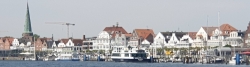
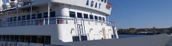
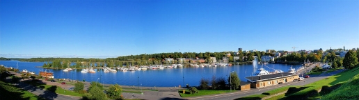
Bild übernommen aus | https://en.wikipedia.org/wiki/Lappeenranta#/media/File:Lappeenranta_harbour.jpg |
Bild hochgeladen | durch Ottocolor am 16.02.2017
|
Informationen zu Urheber-Rechten | |
|---|---|
Rechte-Inhaber | MKFI |
Rechte-Ausprägung / Lizenz | by-sa: CREATIVE COMMONS Namensnennung, Weitergabe unter gleichen Bedingungen |
Link zur Rechtebeschreibung | |
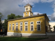
Bild übernommen aus | https://en.wikipedia.org/wiki/Lappeenranta#/media/File:Lappeenranta_town_hall.JPG |
Bild hochgeladen | durch Ottocolor am 16.02.2017
|
Informationen zu Urheber-Rechten | |
|---|---|
Rechte-Inhaber | GAlexandrova |
Rechte-Ausprägung / Lizenz | by-sa: CREATIVE COMMONS Namensnennung, Weitergabe unter gleichen Bedingungen |
Link zur Rechtebeschreibung | |
Bild übernommen aus | |
Bild hochgeladen | durch Ottocolor am 16.02.2017
|
Lappeenranta (Swedish: Villmanstrand) is a city and municipality situated on the shore of the lake Saimaa ![]() in South-Eastern Finland, about 30 kilometres (19 miles) from the Russian border. It belongs to the region of South Karelia. With approximately 73,000 inhabitants (31 March 2016) Lappeenranta is the 13th largest city in Finland. The neighboring municipality of Joutseno
in South-Eastern Finland, about 30 kilometres (19 miles) from the Russian border. It belongs to the region of South Karelia. With approximately 73,000 inhabitants (31 March 2016) Lappeenranta is the 13th largest city in Finland. The neighboring municipality of Joutseno ![]() was consolidated with Lappeenranta on January 1, 2009, and the neighboring municipality of Ylämaa
was consolidated with Lappeenranta on January 1, 2009, and the neighboring municipality of Ylämaa ![]() on January 1, 2010. Lappeenranta is known as an international university city in Finland with Lappeenranta University of Technology and Saimaa University of Applied Sciences which together have approximately 13,000 students from 68 countries. Lappeenranta is also a commercial centre of South-East Finland and the meeting point of the EU and Russia, 215 km from both Helsinki and St. Petersburg. Location on the southern shore of Lake Saimaa makes the city the region’s centre for tourism. Lappeenranta is second most visited city by Russian tourists in Finland after Helsinki and it competes with Helsinki for the largest share of tax-free sales in Finland.
on January 1, 2010. Lappeenranta is known as an international university city in Finland with Lappeenranta University of Technology and Saimaa University of Applied Sciences which together have approximately 13,000 students from 68 countries. Lappeenranta is also a commercial centre of South-East Finland and the meeting point of the EU and Russia, 215 km from both Helsinki and St. Petersburg. Location on the southern shore of Lake Saimaa makes the city the region’s centre for tourism. Lappeenranta is second most visited city by Russian tourists in Finland after Helsinki and it competes with Helsinki for the largest share of tax-free sales in Finland.
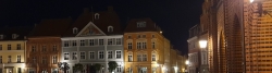
Lappeenranta was originally formed around a headland pointing to lake Saimaa. In the 16th century, the market place moved from Lappee's old centre Kauskila to the current fortress headland. The first mention of Lapwes, as it was called, is in a privilege charter from 1542 that subjugated the market place under Viborg's authority.
The town was chartered in 1649 by Queen Christina of Sweden, legitimizing the trade in the then popular marketplace of Lapvesi. However, the parliamentary privilege charter and the coat of arms were attested in 1652 after the town layout by Erik Aspegren was affirmed. At the time, Lappeenranta was an important port for tar.
Between 1721 and 1743, Lappeenranta was the capital of Kymmenegård and Savonlinna province.
In 1741, the battle of Villmanstrand was fought between the Swedish and Russian armies in the Russo-Swedish War of 1741–1743. The battle ended in a Russian victory. The town was pillaged, wooden structures including the provincial chancellery were burnt and the ecclesiastical archives damaged.
The municipalities of Lappee and Lauritsala were annexed to Lappeenranta in 1967. Nuijamaa joined in 1989. During the financial downturn of 2009 and 2010, Joutseno ![]() and Ylämaa
and Ylämaa ![]() respectively merged into Lappeenranta.
respectively merged into Lappeenranta.
Lappeenranta is known as a summer city, mostly due to its closeness to the Lake Saimaa ![]() . Europe’s 4th largest lake. The eponymous GoSaimaa (www.gosaimaa.com) provides all the touristic activities in the area. In addition, its inland location means that summers tend to be warmer and winters colder than along the coastal areas.
. Europe’s 4th largest lake. The eponymous GoSaimaa (www.gosaimaa.com) provides all the touristic activities in the area. In addition, its inland location means that summers tend to be warmer and winters colder than along the coastal areas.
Lappeenranta does have a healthy winter tourism industry. Various cabins around Lake Saimaa, as well as numerous snowmobiles, Nordic skating, floating in the river, reindeer rides, paragliding, skiing and sledding tracks draw a fair number of winter visitors.
The proximity of the Russian border is increasingly visible in the number of Russian tourists visiting the city. In fact, Lappeenranta is closer (195 km or 121 miles) to Saint Petersburg than Helsinki, the capital of Finland (220 km or 140 miles). The presence of Russian tourists is noticeable by the many Russian registered cars on the streets and the use of Cyrillic letters in signs of some shops.
Places and events
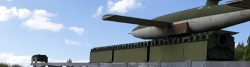
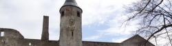
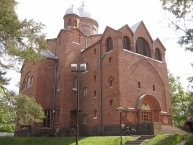
- The old fortress, with a number of museums, cafés and the oldest Russian Orthodox church in Finland.
- St. Mary's Church of Lappee
 , an 18th-century wooden church in the center of the city.
 - The harbour area, with cruises to Vyborg and the nearby Saimaa Canal .
- The central market place, where you can enjoy the local specialities, such as meat pies known as "Atomi" (atom) or "Vety" (hydrogen).
- The Night of The Fortess, a two-day cultural festival held in early August.
- The Lappeenranta Ballet Gala in late August.
- The annual Lappeenranta National Singing Contest.
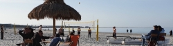
- The biggest sand castle in Finland is built next to Port of Lappeenranta every summer.
Informationen zu Urheber-Rechten | |
|---|---|
Rechte-Ausprägung / Lizenz | by-sa: CREATIVE COMMONS Namensnennung, Weitergabe unter gleichen Bedingungen |
Link zur Rechtebeschreibung | |
Text(e) übernommen von: |
Lappeenranta. (2017, February 12). In Wikipedia, The Free Encyclopedia. Retrieved 17:15, February 16, 2017, from https://en.wikipedia.org/w/index.php?title=Lappeenranta&oldid=765153375 |
übernommen / bearbeitet am | 16.02.2017
|
übernommen / bearbeitet durch |
|
31 km
1,5 km
101 m
31 km
0,4 km
90 m
![]()