
Cycle Route EuroVelo: Iron Curtain Trail - part Norway - Germany
No. of cycle route EV13
Actions
![]()
Please wait - map data are loading
Added on 05 Oct 2011,
last edited by biroto-Redaktion on 18 Nov 2023
Actions
Cycle route metrics
Total distance in km
6.475
Information about rights to the gps-track data | |
|---|---|
Rights owner | OpenStreetMap and Contributors + biroto-Redaktion (biroto.eu) |
Rights characteristic / license | Contains information from OpenStreetMap, which is made available here under the Open Database License(ODbL) |
Link to the description of the license | |
GPX file taken from | |
GPX file uploaded | by biroto-Redaktion on 18 Nov 2023
|
Track points in total
73.660
Track points per km (avg)
11
Start/endpoint
Start location
Kirkenes, NO (9 m NHN)
End location
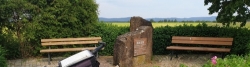
Regnitzlosau, BY, DE (544 m NHN)
Character
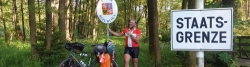
The Iron Curtain Trail (ICT), also known as EuroVelo 13 (EV13), is a partially complete long-distance cycling route which will run along the entire length of the former Iron Curtain ![]() . During the period of the Cold War (c. 1947-1991), the Iron Curtain delineated the border between the Communist East and the capitalist West, the East being the Warsaw Pact countries of the Soviet bloc and the West being the countries of NATO.
. During the period of the Cold War (c. 1947-1991), the Iron Curtain delineated the border between the Communist East and the capitalist West, the East being the Warsaw Pact countries of the Soviet bloc and the West being the countries of NATO.
As of December 2013, many parts of the ICT are already complete, particularly in the central section, such as most of the German part and along the Czech border. When complete, the Iron Curtain Trail will run for 7,650 km (4,750 mi) from the Barents Sea down to the Black Sea.
The Iron Curtain Trail, which is closely related to the European Green Belt ![]() project, is being managed as three projects:
project, is being managed as three projects:
- The northern part is over 4,127 km (2,564 mi) in length from the Barents Sea, along the Finnish-Russian border, along the Baltic Coast, to the German-Polish border.
- The central section passes straight through Germany, following the old border between East Germany and West Germany. It then follows the current borders of the Czech Republic—Austria, Austria—Slovakia, Austria–Hungary and Slovenia for a distance of 2,179 km (1,354 mi).
- The southern part travels 1,335 km (830 mi) along the borders of Croatia, Serbia, Romania, Bulgaria, Macedonia, Greece and Turkey to the Black Sea
Information about copyright | |
|---|---|
Rights characteristic / license | by-sa: CREATIVE COMMONS Attribution-ShareAlike |
Link to the description of the license | |
Input taken over from: |
Wikipedia contributors, 'EV13 The Iron Curtain Trail', Wikipedia, The Free Encyclopedia, 27 September 2014, 09:02 UTC, http://en.wikipedia.org/w/index.php?title=EV13_The_Iron_Curtain_Trail&oldid=627258348 |
taken over / edited on | 19 Nov 2014 - 18 Nov 2023
|
taken over / edited by |
|
Signposting
In Estonia |
|
In Deutschland |
|


Sources of information
WebSites:
- Official Homepage of the Cycle Route Iron Curtain Trail
- at European Cyclists Federation
Prints (Guidebooks/maps):
- Esterbauer bikeline: Iron Curtain Trail
Part 1: Along the "Green Belt" from the Barents Sea to the German-Polish Border - Esterbauer bikeline: Iron Curtain Trail
Part 2: Along the "Green Belt" from Usedom via the German-German Border Trail to the Czech Border. 1:85.000, 1.600 km - Esterbauer bikeline: Iron Curtain Trail
Part 3 Along the "Green Belt" from the German-Czech Border to the Black Sea
Connecting cycle path
Remarks
This route consists of the at OpenCycleMap available sections of EV13 and the routes of national and regional cycling networks:
- Norwegen:
- Finnland:
- ʺIron Curtain Trailʺ- Finnland (planned route, condition unknown)
- Russland:
- Iwangorod - Vyborg - Finish border (partly planned route of R1, rest compiled from maps and satellite images)
- Estland:
- Coast Route Estland (EE1)
- Lettland:
- National Park Route (LV2)
- Burgenroute Kurland - Latvia (LV1)
- Litauen:
- Seaside cycle route (LT5)
- Russland:
- Baltic Sea Cycle Route (EV10)
- Polen:
- Deutschland:
- Baltic Sea Cycle Route Germany (D2)
- German Green Belt (EV13)
Travel reports about cycle tours
Information about copyright | |
|---|---|
Rights owner | |
Rights characteristic / license | by-sa: CREATIVE COMMONS Attribution-ShareAlike |
Link to the description of the license | |
Image has been uploaded | by Ottocolor on 07 Jul 2017
|
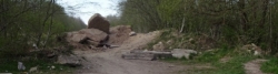
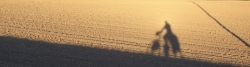
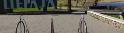
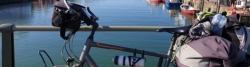
21 May 2017
118 km
A stage of the tour »Iron Curtain Tour, part 1: Klaipeda-Grense Jakobselv« of user Ottocolor
Information about copyright | |
|---|---|
Rights owner | |
Rights characteristic / license | by-sa: CREATIVE COMMONS Attribution-ShareAlike |
Link to the description of the license | |
Image has been uploaded | by Ottocolor on 07 Jul 2017
|
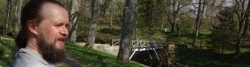
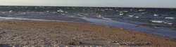
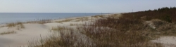
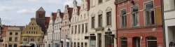
20 May 2017
96 km
A stage of the tour »Iron Curtain Tour, part 1: Klaipeda-Grense Jakobselv« of user Ottocolor
Information about copyright | |
|---|---|
Rights owner | |
Rights characteristic / license | by-sa: CREATIVE COMMONS Attribution-ShareAlike |
Link to the description of the license | |
Image has been uploaded | by Ottocolor on 07 Jul 2017
|
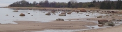
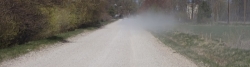
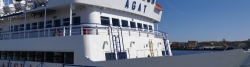
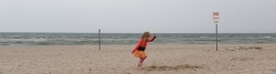
19 May 2017
87 km
A stage of the tour »Iron Curtain Tour, part 1: Klaipeda-Grense Jakobselv« of user Ottocolor
Information about copyright | |
|---|---|
Rights owner | |
Rights characteristic / license | by-sa: CREATIVE COMMONS Attribution-ShareAlike |
Link to the description of the license | |
Image has been uploaded | by Ottocolor on 07 Jul 2017
|
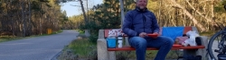
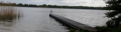
18 May 2017
107 km
A stage of the tour »Iron Curtain Tour, part 1: Klaipeda-Grense Jakobselv« of user Ottocolor
Information about copyright | |
|---|---|
Rights owner | |
Rights characteristic / license | by-sa: CREATIVE COMMONS Attribution-ShareAlike |
Link to the description of the license | |
Image has been uploaded | by Ottocolor on 04 Jul 2017
|
16 May 2017
99 km
A stage of the tour »Iron Curtain Tour, part 1: Klaipeda-Grense Jakobselv« of user Ottocolor
Information about copyright | |
|---|---|
Rights owner | |
Rights characteristic / license | by-sa: CREATIVE COMMONS Attribution-ShareAlike |
Link to the description of the license | |
Image has been uploaded | by Ottocolor on 04 Jul 2017
|
15 May 2017
67 km
A stage of the tour »Iron Curtain Tour, part 1: Klaipeda-Grense Jakobselv« of user Ottocolor
Information about copyright | |
|---|---|
Rights owner | |
Rights characteristic / license | by-sa: CREATIVE COMMONS Attribution-ShareAlike |
Link to the description of the license | |
Image has been uploaded | by Ottocolor on 04 Jul 2017
|
13 May 2017
102 km
A stage of the tour »Iron Curtain Tour, part 1: Klaipeda-Grense Jakobselv« of user Ottocolor
Information about copyright | |
|---|---|
Rights owner | |
Rights characteristic / license | by-sa: CREATIVE COMMONS Attribution-ShareAlike |
Link to the description of the license | |
Image has been uploaded | by Ottocolor on 04 Jul 2017
|
12 May 2017
111 km
A stage of the tour »Iron Curtain Tour, part 1: Klaipeda-Grense Jakobselv« of user Ottocolor
Information about copyright | |
|---|---|
Rights owner | |
Rights characteristic / license | by-sa: CREATIVE COMMONS Attribution-ShareAlike |
Link to the description of the license | |
Image has been uploaded | by Ottocolor on 04 Jul 2017
|
11 May 2017
103 km
A stage of the tour »Iron Curtain Tour, part 1: Klaipeda-Grense Jakobselv« of user Ottocolor
Information about copyright | |
|---|---|
Rights owner | |
Rights characteristic / license | by-sa: CREATIVE COMMONS Attribution-ShareAlike |
Link to the description of the license | |
Image has been uploaded | by Ottocolor on 04 Jul 2017
|
09 May 2017
125 km
A stage of the tour »Iron Curtain Tour, part 1: Klaipeda-Grense Jakobselv« of user Ottocolor
Information about copyright | |
|---|---|
Rights owner | |
Rights characteristic / license | by-sa: CREATIVE COMMONS Attribution-ShareAlike |
Link to the description of the license | |
Image has been uploaded | by Ottocolor on 03 Jul 2017
|
08 May 2017
130 km
A stage of the tour »Iron Curtain Tour, part 1: Klaipeda-Grense Jakobselv« of user Ottocolor
Information about copyright | |
|---|---|
Rights owner | |
Rights characteristic / license | by-sa: CREATIVE COMMONS Attribution-ShareAlike |
Link to the description of the license | |
Image has been uploaded | by Ottocolor on 03 Jul 2017
|
07 May 2017
114 km
A stage of the tour »Iron Curtain Tour, part 1: Klaipeda-Grense Jakobselv« of user Ottocolor
Information about copyright | |
|---|---|
Rights owner | |
Rights characteristic / license | by-sa: CREATIVE COMMONS Attribution-ShareAlike |
Link to the description of the license | |
Image has been uploaded | by Ottocolor on 03 Jul 2017
|
06 May 2017
58 km
A stage of the tour »Iron Curtain Tour, part 1: Klaipeda-Grense Jakobselv« of user Ottocolor
Information about copyright | |
|---|---|
Rights owner | |
Rights characteristic / license | by-sa: CREATIVE COMMONS Attribution-ShareAlike |
Link to the description of the license | |
Image has been uploaded | by Ottocolor on 03 Jul 2017
|
05 May 2017
82 km
A stage of the tour »Iron Curtain Tour, part 1: Klaipeda-Grense Jakobselv« of user Ottocolor
Information about copyright | |
|---|---|
Rights owner | |
Rights characteristic / license | by-sa: CREATIVE COMMONS Attribution-ShareAlike |
Link to the description of the license | |
Image has been uploaded | by Ottocolor on 18 Jun 2023
|
09 May 2023
81 km
A stage of the tour »Iron Curtain Tour, part 3 Gdynia-Aš« of user Ottocolor
Information about copyright | |
|---|---|
Rights owner | |
Rights characteristic / license | by-sa: CREATIVE COMMONS Attribution-ShareAlike |
Link to the description of the license | |
Image has been uploaded | by Ottocolor on 18 Jun 2023
|
10 May 2023
61 km
A stage of the tour »Iron Curtain Tour, part 3 Gdynia-Aš« of user Ottocolor
Information about copyright | |
|---|---|
Rights owner | |
Rights characteristic / license | by-sa: CREATIVE COMMONS Attribution-ShareAlike |
Link to the description of the license | |
Image has been uploaded | by Ottocolor on 18 Jun 2023
|
11 May 2023
43 km
A stage of the tour »Iron Curtain Tour, part 3 Gdynia-Aš« of user Ottocolor
Information about copyright | |
|---|---|
Rights owner | |
Rights characteristic / license | by-sa: CREATIVE COMMONS Attribution-ShareAlike |
Link to the description of the license | |
Image has been uploaded | by Ottocolor on 18 Jun 2023
|
12 May 2023
88 km
A stage of the tour »Iron Curtain Tour, part 3 Gdynia-Aš« of user Ottocolor
Information about copyright | |
|---|---|
Rights owner | |
Rights characteristic / license | by-sa: CREATIVE COMMONS Attribution-ShareAlike |
Link to the description of the license | |
Image has been uploaded | by Ottocolor on 18 Jun 2023
|
13 May 2023
78 km
A stage of the tour »Iron Curtain Tour, part 3 Gdynia-Aš« of user Ottocolor
Information about copyright | |
|---|---|
Rights owner | |
Rights characteristic / license | by-sa: CREATIVE COMMONS Attribution-ShareAlike |
Link to the description of the license | |
Image has been uploaded | by Ottocolor on 18 Jun 2023
|
14 May 2023
74 km
A stage of the tour »Iron Curtain Tour, part 3 Gdynia-Aš« of user Ottocolor
Information about copyright | |
|---|---|
Rights owner | |
Rights characteristic / license | by-sa: CREATIVE COMMONS Attribution-ShareAlike |
Link to the description of the license | |
Image has been uploaded | by Ottocolor on 18 Jun 2023
|
15 May 2023
19 km
A stage of the tour »Iron Curtain Tour, part 3 Gdynia-Aš« of user Ottocolor
Information about copyright | |
|---|---|
Rights owner | |
Rights characteristic / license | by-sa: CREATIVE COMMONS Attribution-ShareAlike |
Link to the description of the license | |
Image has been uploaded | by Ottocolor on 18 Jun 2023
|
16 May 2023
49 km
A stage of the tour »Iron Curtain Tour, part 3 Gdynia-Aš« of user Ottocolor
Information about copyright | |
|---|---|
Rights owner | |
Rights characteristic / license | by-sa: CREATIVE COMMONS Attribution-ShareAlike |
Link to the description of the license | |
Image has been uploaded | by Ottocolor on 18 Jun 2023
|
17 May 2023
71 km
A stage of the tour »Iron Curtain Tour, part 3 Gdynia-Aš« of user Ottocolor
Information about copyright | |
|---|---|
Rights owner | |
Rights characteristic / license | by-sa: CREATIVE COMMONS Attribution-ShareAlike |
Link to the description of the license | |
Image has been uploaded | by Ottocolor on 18 Jun 2023
|
18 May 2023
65 km
A stage of the tour »Iron Curtain Tour, part 3 Gdynia-Aš« of user Ottocolor
Information about copyright | |
|---|---|
Rights owner | |
Rights characteristic / license | by-sa: CREATIVE COMMONS Attribution-ShareAlike |
Link to the description of the license | |
Image has been uploaded | by Ottocolor on 18 Jun 2023
|
19 May 2023
79 km
A stage of the tour »Iron Curtain Tour, part 3 Gdynia-Aš« of user Ottocolor
Information about copyright | |
|---|---|
Rights owner | |
Rights characteristic / license | by-sa: CREATIVE COMMONS Attribution-ShareAlike |
Link to the description of the license | |
Image has been uploaded | by Ottocolor on 18 Jun 2023
|
20 May 2023
47 km
A stage of the tour »Iron Curtain Tour, part 3 Gdynia-Aš« of user Ottocolor
Information about copyright | |
|---|---|
Rights owner | |
Rights characteristic / license | by-sa: CREATIVE COMMONS Attribution-ShareAlike |
Link to the description of the license | |
Image has been uploaded | by Ottocolor on 18 Jun 2023
|
21 May 2023
58 km
A stage of the tour »Iron Curtain Tour, part 3 Gdynia-Aš« of user Ottocolor
Information about copyright | |
|---|---|
Rights owner | |
Rights characteristic / license | by-sa: CREATIVE COMMONS Attribution-ShareAlike |
Link to the description of the license | |
Image has been uploaded | by Ottocolor on 18 Jun 2023
|
23 May 2023
95 km
A stage of the tour »Iron Curtain Tour, part 3 Gdynia-Aš« of user Ottocolor
Information about copyright | |
|---|---|
Rights owner | |
Rights characteristic / license | by-sa: CREATIVE COMMONS Attribution-ShareAlike |
Link to the description of the license | |
Image has been uploaded | by Ottocolor on 18 Jun 2023
|
24 May 2023
89 km
A stage of the tour »Iron Curtain Tour, part 3 Gdynia-Aš« of user Ottocolor
Information about copyright | |
|---|---|
Rights owner | |
Rights characteristic / license | by-sa: CREATIVE COMMONS Attribution-ShareAlike |
Link to the description of the license | |
Image has been uploaded | by Ottocolor on 18 Jun 2023
|
25 May 2023
83 km
A stage of the tour »Iron Curtain Tour, part 3 Gdynia-Aš« of user Ottocolor
Information about copyright | |
|---|---|
Rights owner | |
Rights characteristic / license | by-sa: CREATIVE COMMONS Attribution-ShareAlike |
Link to the description of the license | |
Image has been uploaded | by Ottocolor on 18 Jun 2023
|
26 May 2023
109 km
A stage of the tour »Iron Curtain Tour, part 3 Gdynia-Aš« of user Ottocolor
Information about copyright | |
|---|---|
Rights owner | |
Rights characteristic / license | by-sa: CREATIVE COMMONS Attribution-ShareAlike |
Link to the description of the license | |
Image has been uploaded | by Ottocolor on 18 Jun 2023
|
27 May 2023
87 km
A stage of the tour »Iron Curtain Tour, part 3 Gdynia-Aš« of user Ottocolor
Information about copyright | |
|---|---|
Rights owner | |
Rights characteristic / license | by-sa: CREATIVE COMMONS Attribution-ShareAlike |
Link to the description of the license | |
Image has been uploaded | by Ottocolor on 18 Jun 2023
|
28 May 2023
84 km
A stage of the tour »Iron Curtain Tour, part 3 Gdynia-Aš« of user Ottocolor
Information about copyright | |
|---|---|
Rights owner | |
Rights characteristic / license | by-sa: CREATIVE COMMONS Attribution-ShareAlike |
Link to the description of the license | |
Image has been uploaded | by Ottocolor on 01 Jul 2023
|
30 May 2023
46 km
A stage of the tour »Iron Curtain Tour, part 3 Gdynia-Aš« of user Ottocolor
Information about copyright | |
|---|---|
Rights owner | |
Rights characteristic / license | by-sa: CREATIVE COMMONS Attribution-ShareAlike |
Link to the description of the license | |
Image has been uploaded | by Ottocolor on 01 Jul 2023
|
31 May 2023
81 km
A stage of the tour »Iron Curtain Tour, part 3 Gdynia-Aš« of user Ottocolor
Information about copyright | |
|---|---|
Rights owner | |
Rights characteristic / license | by-sa: CREATIVE COMMONS Attribution-ShareAlike |
Link to the description of the license | |
Image has been uploaded | by Ottocolor on 01 Jul 2023
|
01 Jun 2023
34 km
A stage of the tour »Iron Curtain Tour, part 3 Gdynia-Aš« of user Ottocolor
Information about copyright | |
|---|---|
Rights owner | |
Rights characteristic / license | by-sa: CREATIVE COMMONS Attribution-ShareAlike |
Link to the description of the license | |
Image has been uploaded | by Ottocolor on 01 Jul 2023
|
02 Jun 2023
81 km
A stage of the tour »Iron Curtain Tour, part 3 Gdynia-Aš« of user Ottocolor
Information about copyright | |
|---|---|
Rights owner | |
Rights characteristic / license | by-sa: CREATIVE COMMONS Attribution-ShareAlike |
Link to the description of the license | |
Image has been uploaded | by Ottocolor on 01 Jul 2023
|
04 Jun 2023
90 km
A stage of the tour »Iron Curtain Tour, part 3 Gdynia-Aš« of user Ottocolor
Information about copyright | |
|---|---|
Rights owner | |
Rights characteristic / license | by-sa: CREATIVE COMMONS Attribution-ShareAlike |
Link to the description of the license | |
Image has been uploaded | by Ottocolor on 01 Jul 2023
|
05 Jun 2023
71 km
A stage of the tour »Iron Curtain Tour, part 3 Gdynia-Aš« of user Ottocolor
Information about copyright | |
|---|---|
Rights owner | |
Rights characteristic / license | by-sa: CREATIVE COMMONS Attribution-ShareAlike |
Link to the description of the license | |
Image has been uploaded | by Ottocolor on 01 Jul 2023
|
06 Jun 2023
54 km
A stage of the tour »Iron Curtain Tour, part 3 Gdynia-Aš« of user Ottocolor
Information about copyright | |
|---|---|
Rights owner | |
Rights characteristic / license | by-sa: CREATIVE COMMONS Attribution-ShareAlike |
Link to the description of the license | |
Image has been uploaded | by Ottocolor on 01 Jul 2023
|
07 Jun 2023
67 km
A stage of the tour »Iron Curtain Tour, part 3 Gdynia-Aš« of user Ottocolor
Information about copyright | |
|---|---|
Rights owner | |
Rights characteristic / license | by-sa: CREATIVE COMMONS Attribution-ShareAlike |
Link to the description of the license | |
Image has been uploaded | by Ottocolor on 01 Jul 2023
|
09 Jun 2023
91 km
A stage of the tour »Iron Curtain Tour, part 3 Gdynia-Aš« of user Ottocolor
Information about copyright | |
|---|---|
Rights owner | |
Rights characteristic / license | by-sa: CREATIVE COMMONS Attribution-ShareAlike |
Link to the description of the license | |
Image has been uploaded | by Ottocolor on 01 Jul 2023
|
10 Jun 2023
71 km
A stage of the tour »Iron Curtain Tour, part 3 Gdynia-Aš« of user Ottocolor
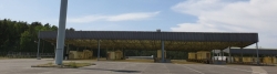
Beds4Cyclists, worth visiting and infrastructure
Name and address
Latitude / Longitude
Phone
Fax
Mobile
Type of accommodation
Rating for cyclists
Route km
Dist. to route
Elevation
97 km
0,3 km
26 m
190 km
0,0 km
247 km
0,1 km
112 m
Information about copyright | |
|---|---|
Rights owner | |
Rights characteristic / license | by-sa: CREATIVE COMMONS Attribution-ShareAlike |
Link to the description of the license | |
Image taken over from | |
Image has been uploaded | by biroto-Redaktion on 24 Jun 2012
|
Information about copyright | |
|---|---|
Rights owner | |
Rights characteristic / license | by-sa: CREATIVE COMMONS Attribution-ShareAlike |
Link to the description of the license | |
Image taken over from | commons.wikimedia.org/wiki/File:Inari_Siida_ulkoilmamuseo.JPG |
Image has been uploaded | by biroto-Redaktion on 24 Jun 2012
|
Information about copyright | |
|---|---|
Rights owner | |
Rights characteristic / license | by-sa: CREATIVE COMMONS Attribution-ShareAlike |
Link to the description of the license | |
Image taken over from | |
Image has been uploaded | by biroto-Redaktion on 24 Jun 2012
|
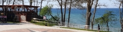
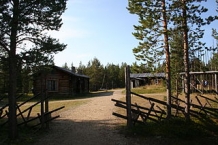
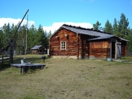
Siida is a museum located on Lake Inari ![]() in the village of Inari
in the village of Inari ![]() in Inari, Finland. It is home to the Sámi Museum and Northern Lapland Nature Centre. Siida arranges exhibitions on Sámi culture and the nature of Northern Lapland. In addition, Siida has an open-air museum
in Inari, Finland. It is home to the Sámi Museum and Northern Lapland Nature Centre. Siida arranges exhibitions on Sámi culture and the nature of Northern Lapland. In addition, Siida has an open-air museum ![]() open in the summers, which was originally known as the Inari Sámi Museum. The first buildings were moved to the museum grounds in 1960. The 7-hectare (17-acre) area has nearly 50 sites of interest related to Lapland's nature and the Sámi and their culture. Furthermore, the area is where the earliest settlers in Northern Lapland lived and archaeological finds from approximately 9,000 years ago have been found.
open in the summers, which was originally known as the Inari Sámi Museum. The first buildings were moved to the museum grounds in 1960. The 7-hectare (17-acre) area has nearly 50 sites of interest related to Lapland's nature and the Sámi and their culture. Furthermore, the area is where the earliest settlers in Northern Lapland lived and archaeological finds from approximately 9,000 years ago have been found.
Information about copyright | |
|---|---|
Rights characteristic / license | by-sa: CREATIVE COMMONS Attribution-ShareAlike |
Link to the description of the license | |
Input taken over from: |
Wikipedia contributors, 'Siida (museum)', Wikipedia, The Free Encyclopedia, 5 March 2012, 05:30 UTC, http://en.wikipedia.org/w/index.php?title=Siida_(museum)&oldid=480273077 [accessed 24 June 2012] |
taken over / edited on | 24 Jun 2012
|
taken over / edited by |
|
Hours of opening
In summer, June 1 – Sept. 19
from 9 a.m. to 8 p.m. daily
248 km
0,0 km
109 m
290 km
0,1 km
114 m
![]()