
EuroVelo: ʺEiserner Vorhangʺ-Radweg - Teil Norwegen - Deutschland
Nr. des Radweges EV13
Aktionen
![]()
Bitte warten - Kartendaten werden geladen
Erstellt am 05.10.2011,
zuletzt geändert von biroto-Redaktion am 18.11.2023
Aktionen
Strecken-Merkmale
Gesamtlänge in km
6.475
Informationen zu Rechten an den GPS-Track-Daten | |
|---|---|
Rechte-Inhaber | OpenStreetMap and Contributors + biroto-Redaktion (biroto.eu) |
Rechte-Ausprägung / Lizenz | Enthält Daten von OpenStreetMap, die hier unter der Open Database License(ODbL) verfügbar gemacht werden |
Link zur Rechtebeschreibung | |
gpx-Datei übernommen aus | |
gpx-Datei hochgeladen | durch biroto-Redaktion am 18.11.2023
|
Gesamtzahl Trackpoints
73.660
Trackpoint-Dichte per km
11
Endorte
Start
Kirkenes, NO (9 m NHN)
Ziel
Regnitzlosau, BY, DE (544 m NHN)
Charakter
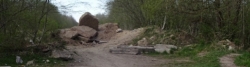
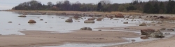
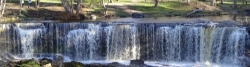
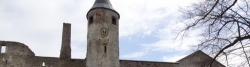
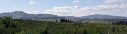
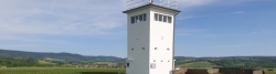
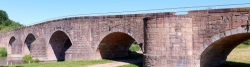
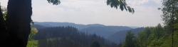
Der ʺEiserner Vorhangʺ-Radweg, auch unter der Bezeichnung "Grünes Band Europa"-Radweg bekannt, führt über etwa 8.500 km von der Barentsee in Norwegen durch 24 europäische Staaten bis zum Schwarzen Meer entlang der Grenzen zwischen dem ehemaligen Ostblock und den Westmächten.
Das Grüne Band Europa (European Green Belt) ist eine Naturschutzinitiative, bei dem der durch den Kalten Krieg entstandene, weitgehend naturnah belassene Grenzstreifen quer durch Europa erhalten werden soll.
Informationen zu Urheber-Rechten | |
|---|---|
Rechte-Ausprägung / Lizenz | by-sa: CREATIVE COMMONS Namensnennung, Weitergabe unter gleichen Bedingungen |
Link zur Rechtebeschreibung | |
übernommen / bearbeitet am | 19.11.2014
|
übernommen / bearbeitet durch |
|
Wegweisung
In Estonia |
|
In Deutschland |
|


Informations-Quellen
WebSites:
- Official Homepage of the Cycle Route Iron Curtain Trail
- at European Cyclists Federation
Prints (Guidebooks/maps):
- Esterbauer bikeline: Iron Curtain Trail
Part 1: Along the "Green Belt" from the Barents Sea to the German-Polish Border - Esterbauer bikeline: Iron Curtain Trail
Part 2: Along the "Green Belt" from Usedom via the German-German Border Trail to the Czech Border. 1:85.000, 1.600 km - Esterbauer bikeline: Iron Curtain Trail
Part 3 Along the "Green Belt" from the German-Czech Border to the Black Sea
Bemerkungen
Die hier beschriebene Route setzt sich aus den bei OpenCycleMap verfügbaren Abschnitten der EV13 und den Routen der nationalen und regionalen Radwege-Netzwerke zusammen:
- Norwegen:
- Finnland:
- ʺEiserner Vorhangʺ-Radweg in Finnland (geplanter Weg, Zustand nicht bekannt)
- Russland:
- Iwangorod - Vyborg - finnische Grenze (teilw. geplante Route des R1, Rest nach Karte und Satellitenbildern zusammengestellt)
- Estland:
- Lettland:
- Litauen:
- Russland:
- Ostseeküstenradweg (EV10)
- Polen:
- Ostseeküstenradweg Polen (EV10)
- Deutschland:
Reiseberichte über Fahrradtouren
Informationen zu Urheber-Rechten | |
|---|---|
Rechte-Inhaber | |
Rechte-Ausprägung / Lizenz | by-sa: CREATIVE COMMONS Namensnennung, Weitergabe unter gleichen Bedingungen |
Link zur Rechtebeschreibung | |
Bild hochgeladen | durch Ottocolor am 07.07.2017
|
21.05.2017
118 km
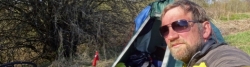
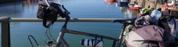
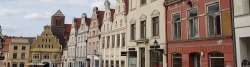
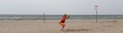
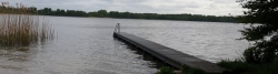
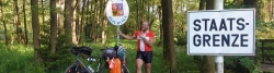
Eine Etappe der Tour »Radtour Eiserner Vorhang, Teil 1: Klaipeda-Grense Jakobselv« von Anwender Ottocolor

Informationen zu Urheber-Rechten | |
|---|---|
Rechte-Inhaber | |
Rechte-Ausprägung / Lizenz | by-sa: CREATIVE COMMONS Namensnennung, Weitergabe unter gleichen Bedingungen |
Link zur Rechtebeschreibung | |
Bild hochgeladen | durch Ottocolor am 07.07.2017
|
20.05.2017
96 km
Eine Etappe der Tour »Radtour Eiserner Vorhang, Teil 1: Klaipeda-Grense Jakobselv« von Anwender Ottocolor

Informationen zu Urheber-Rechten | |
|---|---|
Rechte-Inhaber | |
Rechte-Ausprägung / Lizenz | by-sa: CREATIVE COMMONS Namensnennung, Weitergabe unter gleichen Bedingungen |
Link zur Rechtebeschreibung | |
Bild hochgeladen | durch Ottocolor am 07.07.2017
|
19.05.2017
87 km
Eine Etappe der Tour »Radtour Eiserner Vorhang, Teil 1: Klaipeda-Grense Jakobselv« von Anwender Ottocolor
Informationen zu Urheber-Rechten | |
|---|---|
Rechte-Inhaber | |
Rechte-Ausprägung / Lizenz | by-sa: CREATIVE COMMONS Namensnennung, Weitergabe unter gleichen Bedingungen |
Link zur Rechtebeschreibung | |
Bild hochgeladen | durch Ottocolor am 07.07.2017
|
18.05.2017
107 km
Eine Etappe der Tour »Radtour Eiserner Vorhang, Teil 1: Klaipeda-Grense Jakobselv« von Anwender Ottocolor
Informationen zu Urheber-Rechten | |
|---|---|
Rechte-Inhaber | |
Rechte-Ausprägung / Lizenz | by-sa: CREATIVE COMMONS Namensnennung, Weitergabe unter gleichen Bedingungen |
Link zur Rechtebeschreibung | |
Bild hochgeladen | durch Ottocolor am 04.07.2017
|
16.05.2017
99 km
Eine Etappe der Tour »Radtour Eiserner Vorhang, Teil 1: Klaipeda-Grense Jakobselv« von Anwender Ottocolor
Informationen zu Urheber-Rechten | |
|---|---|
Rechte-Inhaber | |
Rechte-Ausprägung / Lizenz | by-sa: CREATIVE COMMONS Namensnennung, Weitergabe unter gleichen Bedingungen |
Link zur Rechtebeschreibung | |
Bild hochgeladen | durch Ottocolor am 04.07.2017
|
15.05.2017
67 km
Eine Etappe der Tour »Radtour Eiserner Vorhang, Teil 1: Klaipeda-Grense Jakobselv« von Anwender Ottocolor

Informationen zu Urheber-Rechten | |
|---|---|
Rechte-Inhaber | |
Rechte-Ausprägung / Lizenz | by-sa: CREATIVE COMMONS Namensnennung, Weitergabe unter gleichen Bedingungen |
Link zur Rechtebeschreibung | |
Bild hochgeladen | durch Ottocolor am 04.07.2017
|
13.05.2017
102 km
Eine Etappe der Tour »Radtour Eiserner Vorhang, Teil 1: Klaipeda-Grense Jakobselv« von Anwender Ottocolor
Informationen zu Urheber-Rechten | |
|---|---|
Rechte-Inhaber | |
Rechte-Ausprägung / Lizenz | by-sa: CREATIVE COMMONS Namensnennung, Weitergabe unter gleichen Bedingungen |
Link zur Rechtebeschreibung | |
Bild hochgeladen | durch Ottocolor am 04.07.2017
|
12.05.2017
111 km
Eine Etappe der Tour »Radtour Eiserner Vorhang, Teil 1: Klaipeda-Grense Jakobselv« von Anwender Ottocolor

Informationen zu Urheber-Rechten | |
|---|---|
Rechte-Inhaber | |
Rechte-Ausprägung / Lizenz | by-sa: CREATIVE COMMONS Namensnennung, Weitergabe unter gleichen Bedingungen |
Link zur Rechtebeschreibung | |
Bild hochgeladen | durch Ottocolor am 04.07.2017
|
11.05.2017
103 km
Eine Etappe der Tour »Radtour Eiserner Vorhang, Teil 1: Klaipeda-Grense Jakobselv« von Anwender Ottocolor
Informationen zu Urheber-Rechten | |
|---|---|
Rechte-Inhaber | |
Rechte-Ausprägung / Lizenz | by-sa: CREATIVE COMMONS Namensnennung, Weitergabe unter gleichen Bedingungen |
Link zur Rechtebeschreibung | |
Bild hochgeladen | durch Ottocolor am 04.07.2017
|
09.05.2017
125 km
Eine Etappe der Tour »Radtour Eiserner Vorhang, Teil 1: Klaipeda-Grense Jakobselv« von Anwender Ottocolor
Informationen zu Urheber-Rechten | |
|---|---|
Rechte-Inhaber | |
Rechte-Ausprägung / Lizenz | by-sa: CREATIVE COMMONS Namensnennung, Weitergabe unter gleichen Bedingungen |
Link zur Rechtebeschreibung | |
Bild hochgeladen | durch Ottocolor am 03.07.2017
|
08.05.2017
130 km
Eine Etappe der Tour »Radtour Eiserner Vorhang, Teil 1: Klaipeda-Grense Jakobselv« von Anwender Ottocolor
Informationen zu Urheber-Rechten | |
|---|---|
Rechte-Inhaber | |
Rechte-Ausprägung / Lizenz | by-sa: CREATIVE COMMONS Namensnennung, Weitergabe unter gleichen Bedingungen |
Link zur Rechtebeschreibung | |
Bild hochgeladen | durch Ottocolor am 03.07.2017
|
07.05.2017
114 km
Eine Etappe der Tour »Radtour Eiserner Vorhang, Teil 1: Klaipeda-Grense Jakobselv« von Anwender Ottocolor
Informationen zu Urheber-Rechten | |
|---|---|
Rechte-Inhaber | |
Rechte-Ausprägung / Lizenz | by-sa: CREATIVE COMMONS Namensnennung, Weitergabe unter gleichen Bedingungen |
Link zur Rechtebeschreibung | |
Bild hochgeladen | durch Ottocolor am 03.07.2017
|
06.05.2017
58 km
Eine Etappe der Tour »Radtour Eiserner Vorhang, Teil 1: Klaipeda-Grense Jakobselv« von Anwender Ottocolor
Informationen zu Urheber-Rechten | |
|---|---|
Rechte-Inhaber | |
Rechte-Ausprägung / Lizenz | by-sa: CREATIVE COMMONS Namensnennung, Weitergabe unter gleichen Bedingungen |
Link zur Rechtebeschreibung | |
Bild hochgeladen | durch Ottocolor am 03.07.2017
|
05.05.2017
82 km
Eine Etappe der Tour »Radtour Eiserner Vorhang, Teil 1: Klaipeda-Grense Jakobselv« von Anwender Ottocolor
Informationen zu Urheber-Rechten | |
|---|---|
Rechte-Inhaber | |
Rechte-Ausprägung / Lizenz | by-sa: CREATIVE COMMONS Namensnennung, Weitergabe unter gleichen Bedingungen |
Link zur Rechtebeschreibung | |
Bild hochgeladen | durch Ottocolor am 18.06.2023
|
09.05.2023
81 km
Eine Etappe der Tour »Eiserner Vorhang Tour, Teil 3 Gdingen-Asch« von Anwender Ottocolor
Informationen zu Urheber-Rechten | |
|---|---|
Rechte-Inhaber | |
Rechte-Ausprägung / Lizenz | by-sa: CREATIVE COMMONS Namensnennung, Weitergabe unter gleichen Bedingungen |
Link zur Rechtebeschreibung | |
Bild hochgeladen | durch Ottocolor am 18.06.2023
|
10.05.2023
61 km
Eine Etappe der Tour »Eiserner Vorhang Tour, Teil 3 Gdingen-Asch« von Anwender Ottocolor
Informationen zu Urheber-Rechten | |
|---|---|
Rechte-Inhaber | |
Rechte-Ausprägung / Lizenz | by-sa: CREATIVE COMMONS Namensnennung, Weitergabe unter gleichen Bedingungen |
Link zur Rechtebeschreibung | |
Bild hochgeladen | durch Ottocolor am 18.06.2023
|
11.05.2023
43 km
Eine Etappe der Tour »Eiserner Vorhang Tour, Teil 3 Gdingen-Asch« von Anwender Ottocolor
Informationen zu Urheber-Rechten | |
|---|---|
Rechte-Inhaber | |
Rechte-Ausprägung / Lizenz | by-sa: CREATIVE COMMONS Namensnennung, Weitergabe unter gleichen Bedingungen |
Link zur Rechtebeschreibung | |
Bild hochgeladen | durch Ottocolor am 18.06.2023
|
12.05.2023
88 km
Eine Etappe der Tour »Eiserner Vorhang Tour, Teil 3 Gdingen-Asch« von Anwender Ottocolor
Informationen zu Urheber-Rechten | |
|---|---|
Rechte-Inhaber | |
Rechte-Ausprägung / Lizenz | by-sa: CREATIVE COMMONS Namensnennung, Weitergabe unter gleichen Bedingungen |
Link zur Rechtebeschreibung | |
Bild hochgeladen | durch Ottocolor am 18.06.2023
|
13.05.2023
78 km
Eine Etappe der Tour »Eiserner Vorhang Tour, Teil 3 Gdingen-Asch« von Anwender Ottocolor
Informationen zu Urheber-Rechten | |
|---|---|
Rechte-Inhaber | |
Rechte-Ausprägung / Lizenz | by-sa: CREATIVE COMMONS Namensnennung, Weitergabe unter gleichen Bedingungen |
Link zur Rechtebeschreibung | |
Bild hochgeladen | durch Ottocolor am 18.06.2023
|
14.05.2023
74 km
Eine Etappe der Tour »Eiserner Vorhang Tour, Teil 3 Gdingen-Asch« von Anwender Ottocolor
Informationen zu Urheber-Rechten | |
|---|---|
Rechte-Inhaber | |
Rechte-Ausprägung / Lizenz | by-sa: CREATIVE COMMONS Namensnennung, Weitergabe unter gleichen Bedingungen |
Link zur Rechtebeschreibung | |
Bild hochgeladen | durch Ottocolor am 18.06.2023
|
15.05.2023
19 km
Eine Etappe der Tour »Eiserner Vorhang Tour, Teil 3 Gdingen-Asch« von Anwender Ottocolor
Informationen zu Urheber-Rechten | |
|---|---|
Rechte-Inhaber | |
Rechte-Ausprägung / Lizenz | by-sa: CREATIVE COMMONS Namensnennung, Weitergabe unter gleichen Bedingungen |
Link zur Rechtebeschreibung | |
Bild hochgeladen | durch Ottocolor am 18.06.2023
|
16.05.2023
49 km
Eine Etappe der Tour »Eiserner Vorhang Tour, Teil 3 Gdingen-Asch« von Anwender Ottocolor
Informationen zu Urheber-Rechten | |
|---|---|
Rechte-Inhaber | |
Rechte-Ausprägung / Lizenz | by-sa: CREATIVE COMMONS Namensnennung, Weitergabe unter gleichen Bedingungen |
Link zur Rechtebeschreibung | |
Bild hochgeladen | durch Ottocolor am 18.06.2023
|
17.05.2023
71 km
Eine Etappe der Tour »Eiserner Vorhang Tour, Teil 3 Gdingen-Asch« von Anwender Ottocolor
Informationen zu Urheber-Rechten | |
|---|---|
Rechte-Inhaber | |
Rechte-Ausprägung / Lizenz | by-sa: CREATIVE COMMONS Namensnennung, Weitergabe unter gleichen Bedingungen |
Link zur Rechtebeschreibung | |
Bild hochgeladen | durch Ottocolor am 18.06.2023
|
18.05.2023
65 km
Eine Etappe der Tour »Eiserner Vorhang Tour, Teil 3 Gdingen-Asch« von Anwender Ottocolor
Informationen zu Urheber-Rechten | |
|---|---|
Rechte-Inhaber | |
Rechte-Ausprägung / Lizenz | by-sa: CREATIVE COMMONS Namensnennung, Weitergabe unter gleichen Bedingungen |
Link zur Rechtebeschreibung | |
Bild hochgeladen | durch Ottocolor am 18.06.2023
|
19.05.2023
79 km
Eine Etappe der Tour »Eiserner Vorhang Tour, Teil 3 Gdingen-Asch« von Anwender Ottocolor
Informationen zu Urheber-Rechten | |
|---|---|
Rechte-Inhaber | |
Rechte-Ausprägung / Lizenz | by-sa: CREATIVE COMMONS Namensnennung, Weitergabe unter gleichen Bedingungen |
Link zur Rechtebeschreibung | |
Bild hochgeladen | durch Ottocolor am 18.06.2023
|
20.05.2023
47 km
Eine Etappe der Tour »Eiserner Vorhang Tour, Teil 3 Gdingen-Asch« von Anwender Ottocolor
Informationen zu Urheber-Rechten | |
|---|---|
Rechte-Inhaber | |
Rechte-Ausprägung / Lizenz | by-sa: CREATIVE COMMONS Namensnennung, Weitergabe unter gleichen Bedingungen |
Link zur Rechtebeschreibung | |
Bild hochgeladen | durch Ottocolor am 18.06.2023
|
21.05.2023
58 km
Eine Etappe der Tour »Eiserner Vorhang Tour, Teil 3 Gdingen-Asch« von Anwender Ottocolor
Informationen zu Urheber-Rechten | |
|---|---|
Rechte-Inhaber | |
Rechte-Ausprägung / Lizenz | by-sa: CREATIVE COMMONS Namensnennung, Weitergabe unter gleichen Bedingungen |
Link zur Rechtebeschreibung | |
Bild hochgeladen | durch Ottocolor am 18.06.2023
|
23.05.2023
95 km
Eine Etappe der Tour »Eiserner Vorhang Tour, Teil 3 Gdingen-Asch« von Anwender Ottocolor
Informationen zu Urheber-Rechten | |
|---|---|
Rechte-Inhaber | |
Rechte-Ausprägung / Lizenz | by-sa: CREATIVE COMMONS Namensnennung, Weitergabe unter gleichen Bedingungen |
Link zur Rechtebeschreibung | |
Bild hochgeladen | durch Ottocolor am 18.06.2023
|
24.05.2023
89 km
Eine Etappe der Tour »Eiserner Vorhang Tour, Teil 3 Gdingen-Asch« von Anwender Ottocolor
Informationen zu Urheber-Rechten | |
|---|---|
Rechte-Inhaber | |
Rechte-Ausprägung / Lizenz | by-sa: CREATIVE COMMONS Namensnennung, Weitergabe unter gleichen Bedingungen |
Link zur Rechtebeschreibung | |
Bild hochgeladen | durch Ottocolor am 18.06.2023
|
25.05.2023
83 km
Eine Etappe der Tour »Eiserner Vorhang Tour, Teil 3 Gdingen-Asch« von Anwender Ottocolor

Informationen zu Urheber-Rechten | |
|---|---|
Rechte-Inhaber | |
Rechte-Ausprägung / Lizenz | by-sa: CREATIVE COMMONS Namensnennung, Weitergabe unter gleichen Bedingungen |
Link zur Rechtebeschreibung | |
Bild hochgeladen | durch Ottocolor am 18.06.2023
|
26.05.2023
109 km
Eine Etappe der Tour »Eiserner Vorhang Tour, Teil 3 Gdingen-Asch« von Anwender Ottocolor
Informationen zu Urheber-Rechten | |
|---|---|
Rechte-Inhaber | |
Rechte-Ausprägung / Lizenz | by-sa: CREATIVE COMMONS Namensnennung, Weitergabe unter gleichen Bedingungen |
Link zur Rechtebeschreibung | |
Bild hochgeladen | durch Ottocolor am 18.06.2023
|
27.05.2023
87 km
Eine Etappe der Tour »Eiserner Vorhang Tour, Teil 3 Gdingen-Asch« von Anwender Ottocolor
Informationen zu Urheber-Rechten | |
|---|---|
Rechte-Inhaber | |
Rechte-Ausprägung / Lizenz | by-sa: CREATIVE COMMONS Namensnennung, Weitergabe unter gleichen Bedingungen |
Link zur Rechtebeschreibung | |
Bild hochgeladen | durch Ottocolor am 18.06.2023
|
28.05.2023
84 km
Eine Etappe der Tour »Eiserner Vorhang Tour, Teil 3 Gdingen-Asch« von Anwender Ottocolor
Informationen zu Urheber-Rechten | |
|---|---|
Rechte-Inhaber | |
Rechte-Ausprägung / Lizenz | by-sa: CREATIVE COMMONS Namensnennung, Weitergabe unter gleichen Bedingungen |
Link zur Rechtebeschreibung | |
Bild hochgeladen | durch Ottocolor am 01.07.2023
|
30.05.2023
46 km
Eine Etappe der Tour »Eiserner Vorhang Tour, Teil 3 Gdingen-Asch« von Anwender Ottocolor
Informationen zu Urheber-Rechten | |
|---|---|
Rechte-Inhaber | |
Rechte-Ausprägung / Lizenz | by-sa: CREATIVE COMMONS Namensnennung, Weitergabe unter gleichen Bedingungen |
Link zur Rechtebeschreibung | |
Bild hochgeladen | durch Ottocolor am 01.07.2023
|
31.05.2023
81 km
Eine Etappe der Tour »Eiserner Vorhang Tour, Teil 3 Gdingen-Asch« von Anwender Ottocolor
Informationen zu Urheber-Rechten | |
|---|---|
Rechte-Inhaber | |
Rechte-Ausprägung / Lizenz | by-sa: CREATIVE COMMONS Namensnennung, Weitergabe unter gleichen Bedingungen |
Link zur Rechtebeschreibung | |
Bild hochgeladen | durch Ottocolor am 01.07.2023
|
01.06.2023
34 km
Eine Etappe der Tour »Eiserner Vorhang Tour, Teil 3 Gdingen-Asch« von Anwender Ottocolor
Informationen zu Urheber-Rechten | |
|---|---|
Rechte-Inhaber | |
Rechte-Ausprägung / Lizenz | by-sa: CREATIVE COMMONS Namensnennung, Weitergabe unter gleichen Bedingungen |
Link zur Rechtebeschreibung | |
Bild hochgeladen | durch Ottocolor am 01.07.2023
|
02.06.2023
81 km
Eine Etappe der Tour »Eiserner Vorhang Tour, Teil 3 Gdingen-Asch« von Anwender Ottocolor
Informationen zu Urheber-Rechten | |
|---|---|
Rechte-Inhaber | |
Rechte-Ausprägung / Lizenz | by-sa: CREATIVE COMMONS Namensnennung, Weitergabe unter gleichen Bedingungen |
Link zur Rechtebeschreibung | |
Bild hochgeladen | durch Ottocolor am 01.07.2023
|
04.06.2023
90 km
Eine Etappe der Tour »Eiserner Vorhang Tour, Teil 3 Gdingen-Asch« von Anwender Ottocolor
Informationen zu Urheber-Rechten | |
|---|---|
Rechte-Inhaber | |
Rechte-Ausprägung / Lizenz | by-sa: CREATIVE COMMONS Namensnennung, Weitergabe unter gleichen Bedingungen |
Link zur Rechtebeschreibung | |
Bild hochgeladen | durch Ottocolor am 01.07.2023
|
05.06.2023
71 km
Eine Etappe der Tour »Eiserner Vorhang Tour, Teil 3 Gdingen-Asch« von Anwender Ottocolor
Informationen zu Urheber-Rechten | |
|---|---|
Rechte-Inhaber | |
Rechte-Ausprägung / Lizenz | by-sa: CREATIVE COMMONS Namensnennung, Weitergabe unter gleichen Bedingungen |
Link zur Rechtebeschreibung | |
Bild hochgeladen | durch Ottocolor am 01.07.2023
|
06.06.2023
54 km
Eine Etappe der Tour »Eiserner Vorhang Tour, Teil 3 Gdingen-Asch« von Anwender Ottocolor
Informationen zu Urheber-Rechten | |
|---|---|
Rechte-Inhaber | |
Rechte-Ausprägung / Lizenz | by-sa: CREATIVE COMMONS Namensnennung, Weitergabe unter gleichen Bedingungen |
Link zur Rechtebeschreibung | |
Bild hochgeladen | durch Ottocolor am 01.07.2023
|
07.06.2023
67 km
Eine Etappe der Tour »Eiserner Vorhang Tour, Teil 3 Gdingen-Asch« von Anwender Ottocolor
Informationen zu Urheber-Rechten | |
|---|---|
Rechte-Inhaber | |
Rechte-Ausprägung / Lizenz | by-sa: CREATIVE COMMONS Namensnennung, Weitergabe unter gleichen Bedingungen |
Link zur Rechtebeschreibung | |
Bild hochgeladen | durch Ottocolor am 01.07.2023
|
09.06.2023
91 km
Eine Etappe der Tour »Eiserner Vorhang Tour, Teil 3 Gdingen-Asch« von Anwender Ottocolor
Informationen zu Urheber-Rechten | |
|---|---|
Rechte-Inhaber | |
Rechte-Ausprägung / Lizenz | by-sa: CREATIVE COMMONS Namensnennung, Weitergabe unter gleichen Bedingungen |
Link zur Rechtebeschreibung | |
Bild hochgeladen | durch Ottocolor am 01.07.2023
|
10.06.2023
71 km
Eine Etappe der Tour »Eiserner Vorhang Tour, Teil 3 Gdingen-Asch« von Anwender Ottocolor
Fahrradfreundliche Unterkünfte, Sehenswertes und Infrastruktur
Name u. Anschrift
Breite / Länge
Tel.
Fax.
Mobile
Art d. Unterkunft
Radler-freund-lichkeit
Strecken-km
km zur Strecke
Höhe
97 km
0,3 km
26 m
190 km
0,0 km
247 km
0,1 km
112 m
Informationen zu Urheber-Rechten | |
|---|---|
Rechte-Inhaber | |
Rechte-Ausprägung / Lizenz | by-sa: CREATIVE COMMONS Namensnennung, Weitergabe unter gleichen Bedingungen |
Link zur Rechtebeschreibung | |
Bild übernommen aus | |
Bild hochgeladen | durch biroto-Redaktion am 24.06.2012
|
Informationen zu Urheber-Rechten | |
|---|---|
Rechte-Inhaber | |
Rechte-Ausprägung / Lizenz | by-sa: CREATIVE COMMONS Namensnennung, Weitergabe unter gleichen Bedingungen |
Link zur Rechtebeschreibung | |
Bild übernommen aus | commons.wikimedia.org/wiki/File:Inari_Siida_ulkoilmamuseo.JPG |
Bild hochgeladen | durch biroto-Redaktion am 24.06.2012
|
Informationen zu Urheber-Rechten | |
|---|---|
Rechte-Inhaber | |
Rechte-Ausprägung / Lizenz | by-sa: CREATIVE COMMONS Namensnennung, Weitergabe unter gleichen Bedingungen |
Link zur Rechtebeschreibung | |
Bild übernommen aus | |
Bild hochgeladen | durch biroto-Redaktion am 24.06.2012
|
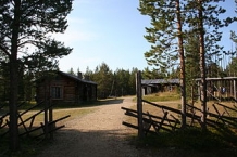
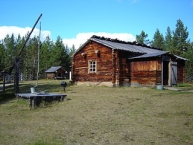
Siida is a museum located on Lake Inari ![]() in the village of Inari
in the village of Inari ![]() in Inari, Finland. It is home to the Sámi Museum and Northern Lapland Nature Centre. Siida arranges exhibitions on Sámi culture and the nature of Northern Lapland. In addition, Siida has an open-air museum
in Inari, Finland. It is home to the Sámi Museum and Northern Lapland Nature Centre. Siida arranges exhibitions on Sámi culture and the nature of Northern Lapland. In addition, Siida has an open-air museum ![]() open in the summers, which was originally known as the Inari Sámi Museum. The first buildings were moved to the museum grounds in 1960. The 7-hectare (17-acre) area has nearly 50 sites of interest related to Lapland's nature and the Sámi and their culture. Furthermore, the area is where the earliest settlers in Northern Lapland lived and archaeological finds from approximately 9,000 years ago have been found.
open in the summers, which was originally known as the Inari Sámi Museum. The first buildings were moved to the museum grounds in 1960. The 7-hectare (17-acre) area has nearly 50 sites of interest related to Lapland's nature and the Sámi and their culture. Furthermore, the area is where the earliest settlers in Northern Lapland lived and archaeological finds from approximately 9,000 years ago have been found.
Informationen zu Urheber-Rechten | |
|---|---|
Rechte-Ausprägung / Lizenz | by-sa: CREATIVE COMMONS Namensnennung, Weitergabe unter gleichen Bedingungen |
Link zur Rechtebeschreibung | |
Text(e) übernommen von: |
Wikipedia contributors, 'Siida (museum)', Wikipedia, The Free Encyclopedia, 5 March 2012, 05:30 UTC, http://en.wikipedia.org/w/index.php?title=Siida_(museum)&oldid=480273077 [accessed 24 June 2012] |
übernommen / bearbeitet am | 24.06.2012
|
übernommen / bearbeitet durch |
|
Öffnungszeiten
In summer, June 1 – Sept. 19
from 9 a.m. to 8 p.m. daily
248 km
0,0 km
109 m
290 km
0,1 km
114 m
![]()